2023/03/04 08:55:49
Avigna
Author
Place
Italy - Trentino-Alto Adige/Südtirol, BZ
Km
48,93 km
Elapsed time
07:02:43
Vertical meters
+2 000 mt (267 - 1787)
Route difficulty
Landscapes
Last update
2023/03/04 22:39:04
Comments
Description
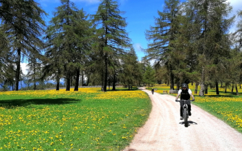
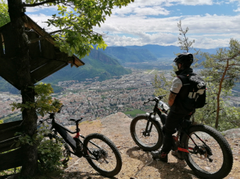
Very challenging and long route with steep climbs, technical trails and beautiful views.

Ideal to be pedaled with an e-bike. From Bolzano you climb up to the plateau on a very steep road to San Genesio. From here it's all alternating between fun forestry and trails both up and down.

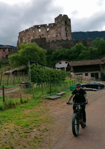
You first reach the village of Avigna and then the Hauser Berg farm, with typical refreshments. Then it's back to Bolzano via trails and forest roads with one last technical trail into town.

Local weather

°C

°C

°C

°C

°C

°C
Graph
Nearest Routes
2023/03/04
- Italy - Trentino-Alto Adige/Südtirol, BZ 27,65 km
Km
+1 100 mt
Vertical meters
Route difficulty
Landscapes
2023/06/02
- Italy - Trentino-Alto Adige/Südtirol, BZ 40,24 km
Km
+3 321 mt
Vertical meters
Route difficulty
Landscapes
2023/03/01
- Italy - Trentino-Alto Adige/Südtirol, BZ 48,48 km
Km
+1 910 mt
Vertical meters
Route difficulty
Landscapes
47,22 km
Km
+1 707 mt
Vertical meters
Route difficulty
Landscapes
20,32 km
Km
+400 mt
Vertical meters
Route difficulty
Landscapes
20,41 km
Km
+780 mt
Vertical meters
Route difficulty
Landscapes
39,17 km
Km
+1 090 mt
Vertical meters
Route difficulty
Landscapes
2022/10/10
- Italy - Trentino-Alto Adige/Südtirol, BZ 46,71 km
Km
+1 235 mt
Vertical meters
Route difficulty
Landscapes
2023/03/04
- Italy - Trentino-Alto Adige/Südtirol, BZ 71,98 km
Km
+2 000 mt
Vertical meters
Route difficulty
Landscapes
2023/03/05
- Italy - Trentino-Alto Adige/Südtirol, BZ 41,94 km
Km
+2 000 mt
Vertical meters
Route difficulty
Landscapes


 Italiano
 Deutsch