HOME RANKINGS CHALLENGES ROUTES POI PLANNING SEARCH LOGIN
Italy - Trentino-Alto Adige/Südtirol, BZ
2023/03/01 08:23:55

Tutta la val Passiria

2 Downloads
0
 
Author
nonnocarb
(266)
Place
Italy - Trentino-Alto Adige/Südtirol, BZ
Km
86,66 km
Elapsed time
06:22:06
Vertical meters
0 mt (303 - 1489)
Route difficulty
Landscapes
Last update
2023/03/01 08:30:39
Comments
0
Description

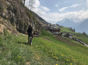
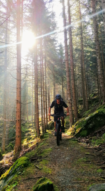
A technically challenging, rather long and tiring but also very scenic and enjoyable itinerary, exploring the entire Val Passiria to Valtina and Plan.

It starts in Merano and goes on a bicycle path to St. Leonhard, with some interesting detours. From here you go up to Valtina on the orographic left side of the stream. You arrive on the Giovo road and descend via path 17.

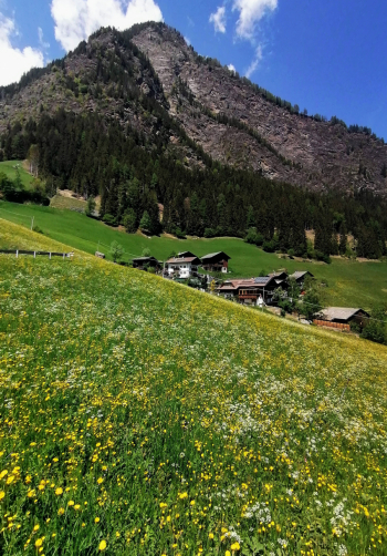
You then ascend to Stulles, take the path to Moso and ascend again to Plan on the old road. At the Zagl farm you cross the stream and head back toward the valley, passing through Plata and then Planlargo. Ascend to Cresta and then descend on a fairly challenging trail to St. Martin and back to Meran with several detours on the left orographic side of the Passer, also passing through Scena.

Download our free mobile app to send this route to your Garmin device or to navigate it on OSM maps. Android - iOS

Graph

Nearest Routes

2022/11/04
- Italy - Trentino-Alto Adige/Südtirol, BZ
nonnocarb
(266)
32,17 km
Km
+1 852 mt
Vertical meters
Route difficulty
Landscapes
2023/03/06
- Italy - Trentino-Alto Adige/Südtirol, BZ
nonnocarb
(266)
32,34 km
Km
+1 500 mt
Vertical meters
Route difficulty
Landscapes
2023/03/01
- Italy - Trentino-Alto Adige/Südtirol, BZ
nonnocarb
(266)
49,83 km
Km
+950 mt
Vertical meters
Route difficulty
Landscapes
2023/03/04
- Italy - Trentino-Alto Adige/Südtirol, BZ
nonnocarb
(266)
71,35 km
Km
+1 830 mt
Vertical meters
Route difficulty
Landscapes
2022/11/01
- Italy - Trentino-Alto Adige/Südtirol, BZ
nonnocarb
(266)
42,55 km
Km
+2 157 mt
Vertical meters
Route difficulty
Landscapes
2023/03/01
- Italy - Trentino-Alto Adige/Südtirol, BZ
nonnocarb
(266)
53,70 km
Km
+1 570 mt
Vertical meters
Route difficulty
Landscapes
2023/03/05
- Italy - Trentino-Alto Adige/Südtirol, BZ
nonnocarb
(266)
31,25 km
Km
+1 100 mt
Vertical meters
Route difficulty
Landscapes
2022/10/22
- Italy - Trentino-Alto Adige/Südtirol, BZ
nonnocarb
(266)
65,78 km
Km
+2 336 mt
Vertical meters
Route difficulty
Landscapes
2022/11/21
- Italy - Trentino-Alto Adige/Südtirol, BZ
nonnocarb
(266)
41,95 km
Km
+1 783 mt
Vertical meters
Route difficulty
Landscapes
2023/03/02
- Italy - Trentino-Alto Adige/Südtirol, BZ
nonnocarb
(266)
51,00 km
Km
+1 610 mt
Vertical meters
Route difficulty
Landscapes

0 Comments