HOME RANKINGS CHALLENGES ROUTES POI PLANNING SEARCH LOGIN
Italy - Trentino-Alto Adige/Südtirol, BZ
2023/03/01 08:15:36

Malga Cavalli e sentiero 3

5 Downloads
2
 
Share
Author
nonnocarb
(292)
Place
Italy - Trentino-Alto Adige/Südtirol, BZ
Km
48,18 km
Elapsed time
06:11:21
Vertical meters
+1 500 mt (1140 - 2337)
Route difficulty
Landscapes
Last update
2023/03/01 08:18:07
Comments
0
Description

The climb to malga Cavalli is really tough, but by ebike you can pedal all of it, with regular mtb at least half pushing.
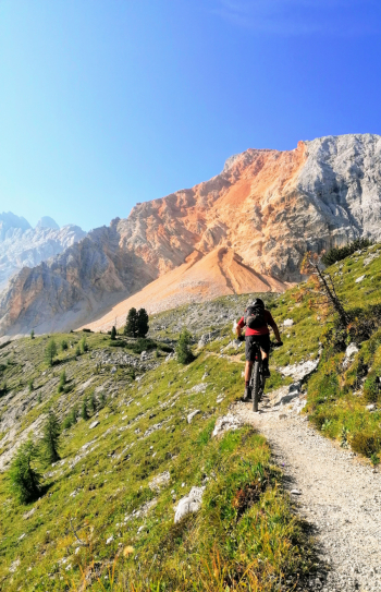
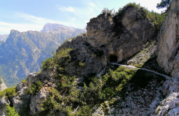
From the malga starts one of the most beautiful trails in the dolomites, trail 3 that goes to Prato Piazza. I had already done it from the opposite side, but done this way, you can pedal almost all the way. Sure, it's not a trail for everyone, especially those afraid of exposed trails, but the views pay off!
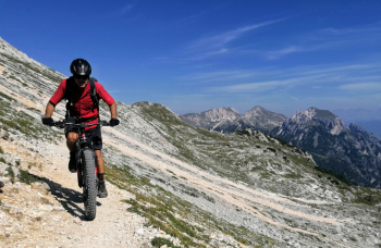
At every corner a fantastic view of the Croda Rossa d' Ampezzo that is constantly changing, you waste more time taking pictures and selfies than pedaling! Especially the section where the mountain collapsed a few years ago is a jaw-dropping red!
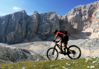
Arriving at Prato Piazza, I climb to the top of Monte Specie, with spectacular views (again) of the Three Peaks of Lavaredo, Cristallo, Tofane, Croda Rossa and Picco di Vallandro.
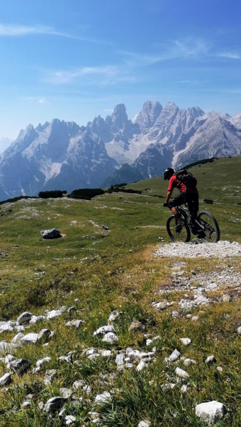
For the descent, I choose Trail 34 to the Landro Valley, which I already know, more than a thousand meters of elevation gain on a technical trail with lots of roots and nose-press hairpin bends, a unique enjoyment that engages me for almost an hour. Return to Villabassa on the comfortable bike path, with a few secret variants.

Tour only for experts and without vertigo!
Download our free mobile app to send this route to your Garmin device or to navigate it on OSM maps. Android - iOS
Local weather
°C
°C
°C
°C
°C
°C
°C
°C
°C
°C

Graph

Nearest Routes

2022/10/28
- Italy - Trentino-Alto Adige/Südtirol, BZ
nonnocarb
(292)
48,18 km
Km
+1 684 mt
Vertical meters
Route difficulty
Landscapes
2023/03/05
- Italy - Trentino-Alto Adige/Südtirol, BZ
nonnocarb
(292)
33,21 km
Km
+750 mt
Vertical meters
Route difficulty
Landscapes
2023/03/05
- Italy - Trentino-Alto Adige/Südtirol, BZ
nonnocarb
(292)
34,64 km
Km
+1 320 mt
Vertical meters
Route difficulty
Landscapes
2023/03/05
- Italy - Trentino-Alto Adige/Südtirol, BZ
nonnocarb
(292)
46,65 km
Km
+450 mt
Vertical meters
Route difficulty
Landscapes
2023/02/26
- Italy - Trentino-Alto Adige/Südtirol, BZ
nonnocarb
(292)
22,60 km
Km
+1 100 mt
Vertical meters
Route difficulty
Landscapes
2023/02/26
- Italy - Trentino-Alto Adige/Südtirol, BZ
nonnocarb
(292)
34,09 km
Km
+1 420 mt
Vertical meters
Route difficulty
Landscapes
2023/03/05
- Italy - Trentino-Alto Adige/Südtirol, BZ
nonnocarb
(292)
28,95 km
Km
+1 110 mt
Vertical meters
Route difficulty
Landscapes
2023/03/05
- Italy - Trentino-Alto Adige/Südtirol, BZ
nonnocarb
(292)
118,42 km
Km
+1 920 mt
Vertical meters
Route difficulty
Landscapes
2023/03/05
- Italy - Trentino-Alto Adige/Südtirol, BZ
nonnocarb
(292)
51,40 km
Km
+1 210 mt
Vertical meters
Route difficulty
Landscapes
2023/02/26
- Italy - Trentino-Alto Adige/Südtirol, BZ
nonnocarb
(292)
28,41 km
Km
+510 mt
Vertical meters
Route difficulty
Landscapes

0 Comments