2023/02/26 21:22:41
Da Valdaora a Versciaco sulla neve
Author
Place
Italy - Trentino-Alto Adige/Südtirol, BZ
Km
53,06 km
Elapsed time
-420853:-32:-56
Vertical meters
+220 mt (1059 - 1230)
Route difficulty
Landscapes
Last update
2023/12/04 13:43:45
Comments
Description
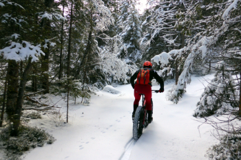
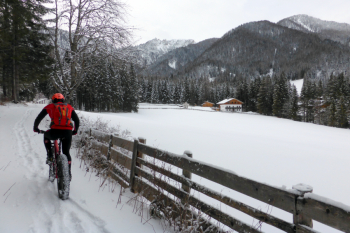
Itinerary to do in winter when the roads are snow-covered, by fat bike, with lots of miles and little elevation gain, all on snow-covered, fat bike-friendly footpaths and very few crossings with cross-country trails (forbidden to bikes).

Almost all on #snow, except passing through villages (Assuming it has snowed). From the Olympia campsite you go to San Candido and then Versciaco. Here you turn back, pass through San Candido, Dobbiaco, then Monguelfo (at the crossing with the Braies valley you pass for 200 meters on the cross-country track, be careful to pass on the sides), pass along the lake of Valdaora and after the dam the snowy road ends.
You walk back to the start. Doable in summer, of course.

Local weather

°C

°C

°C

°C

°C

°C
Graph
Nearest Routes
2024/07/25
- Italy - Trentino-Alto Adige/Südtirol, BZ 56,06 km
Km
+1 900 mt
Vertical meters
Route difficulty
Landscapes
2023/03/04
- Italy - Trentino-Alto Adige/Südtirol, BZ 37,05 km
Km
+1 550 mt
Vertical meters
Route difficulty
Landscapes
35,05 km
Km
+505 mt
Vertical meters
Route difficulty
Landscapes
76,61 km
Km
+2 400 mt
Vertical meters
Route difficulty
Landscapes
71,87 km
Km
+1 820 mt
Vertical meters
Route difficulty
Landscapes
28,41 km
Km
+510 mt
Vertical meters
Route difficulty
Landscapes
30,64 km
Km
+890 mt
Vertical meters
Route difficulty
Landscapes
20,17 km
Km
+1 136 mt
Vertical meters
Route difficulty
Landscapes
22,60 km
Km
+1 100 mt
Vertical meters
Route difficulty
Landscapes
55,01 km
Km
+1 450 mt
Vertical meters
Route difficulty
Landscapes


 Italiano
 Deutsch