HOME RANKINGS CHALLENGES ROUTES POI PLANNING SEARCH LOGIN
Italy - Trentino-Alto Adige/Südtirol, BZ
2023/03/01 08:35:06

Tutta la Alta val Pusteria

4 Downloads
0
 
Author
nonnocarb
(266)
Place
Italy - Trentino-Alto Adige/Südtirol, BZ
Km
76,61 km
Elapsed time
09:16:04
Vertical meters
+2 400 mt (1173 - 2313)
Route difficulty
Landscapes
Last update
2023/03/01 08:36:46
Comments
0
Description

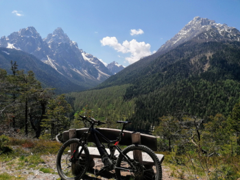
A very spectacular and scenic route, but also very challenging to do in the Upper Pusteria Valley. Ideal to do it with an e-mtb. The most difficult part is definitely the steep climb up to the Bonner hut, with many stretches over 25%, although once you get to the top you are rewarded by an amazing view (and also good refreshments if the hut is open, inquire beforehand about opening hours).

Also beware, the path from the Bonner hut is forbidden to bikes because it is very narrow and exposed, do it only if in possession of a very good driving technique and never in high season and on weekends, due to the crossing with numerous hikers. As an alternative to this trail and the previous steep ascent, you can go directly up through the San Silvestro valley and then rejoin the trail.

You then descend to San Candido, ascend to Mt. Elmo, descend to Moso along the beautiful Erla trail (or by forestry for the less technical), ascend to Rif. Tre Scarperi, descend along the beautiful trail, then again up to Rif. Baranci and last descent to Dobbiaco and the campsite.

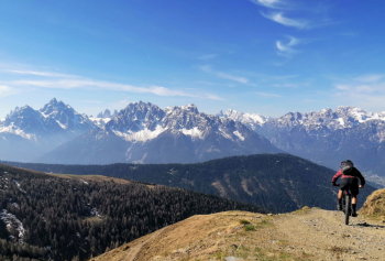
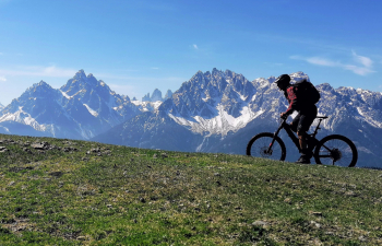
Spectacular but very challenging route, only for experienced and very trained bikers.

Download our free mobile app to send this route to your Garmin device or to navigate it on OSM maps. Android - iOS

Graph

Nearest Routes

2023/03/04
- Italy - Trentino-Alto Adige/Südtirol, BZ
nonnocarb
(266)
71,87 km
Km
+1 820 mt
Vertical meters
Route difficulty
Landscapes
2023/02/26
- Italy - Trentino-Alto Adige/Südtirol, BZ
nonnocarb
(266)
35,05 km
Km
+505 mt
Vertical meters
Route difficulty
Landscapes
2023/03/04
- Italy - Trentino-Alto Adige/Südtirol, BZ
nonnocarb
(266)
37,05 km
Km
+1 550 mt
Vertical meters
Route difficulty
Landscapes
2023/03/06
- Italy - Trentino-Alto Adige/Südtirol, BZ
nonnocarb
(266)
30,64 km
Km
+890 mt
Vertical meters
Route difficulty
Landscapes
2022/10/22
- Italy - Trentino-Alto Adige/Südtirol, BZ
nonnocarb
(266)
20,17 km
Km
+1 136 mt
Vertical meters
Route difficulty
Landscapes
2023/03/04
- Italy - Trentino-Alto Adige/Südtirol, BZ
nonnocarb
(266)
55,01 km
Km
+1 450 mt
Vertical meters
Route difficulty
Landscapes
2023/03/05
- Italy - Trentino-Alto Adige/Südtirol, BZ
nonnocarb
(266)
28,95 km
Km
+1 110 mt
Vertical meters
Route difficulty
Landscapes
2023/02/26
- Italy - Trentino-Alto Adige/Südtirol, BZ
nonnocarb
(266)
34,09 km
Km
+1 420 mt
Vertical meters
Route difficulty
Landscapes
2023/03/05
- Italy - Trentino-Alto Adige/Südtirol, BZ
nonnocarb
(266)
46,65 km
Km
+450 mt
Vertical meters
Route difficulty
Landscapes
2023/03/05
- Italy - Trentino-Alto Adige/Südtirol, BZ
nonnocarb
(266)
34,64 km
Km
+1 320 mt
Vertical meters
Route difficulty
Landscapes

0 Comments