2022/08/22 18:12:54
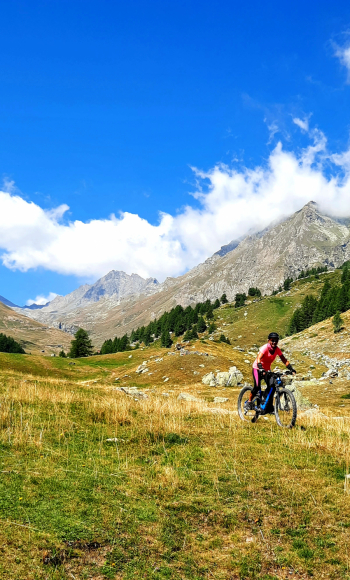
Al lago Miserin
Author
Place
Italy - Valle d'Aosta, AO
Km
30,60 km
Elapsed time
07:18:36
Vertical meters
+1 265 mt (1412 - 2581)
Route difficulty
Landscapes
Last update
2023/01/03 16:52:51
Comments
Description
Very scenic route to discover Lake Miserin, at the top of the Champorcher valley. From the village parking lot, climb first on asphalt, then on dirt road to the Dodena refuge. From here the road becomes steeper and rougher, until you reach the Miserin refuge with the lake of the same name, in beautiful high mountain surroundings. The return can be done on the same road or on the trail that cuts into the valley and goes directly to Champorcher

Local weather

°C

°C

°C

°C

°C

°C
Graph
Nearest Routes
2022/08/06
- Italy - Valle d'Aosta, AO 29,26 km
Km
+1 467 mt
Vertical meters
Route difficulty
Landscapes
24,52 km
Km
+466 mt
Vertical meters
Route difficulty
Landscapes
18,95 km
Km
+1 050 mt
Vertical meters
Route difficulty
Landscapes
26,19 km
Km
+2 200 mt
Vertical meters
Route difficulty
Landscapes
33,54 km
Km
+1 450 mt
Vertical meters
Route difficulty
Landscapes
25,12 km
Km
+1 122 mt
Vertical meters
Route difficulty
Landscapes
2022/09/04
- Italy - Valle d'Aosta, AO 32,99 km
Km
+1 458 mt
Vertical meters
Route difficulty
Landscapes
28,72 km
Km
+1 121 mt
Vertical meters
Route difficulty
Landscapes
2022/09/16
- Italy - Valle d'Aosta, AO 45,84 km
Km
+2 206 mt
Vertical meters
Route difficulty
Landscapes
2024/05/08
- Italy - Valle d'Aosta, AO 32,97 km
Km
+1 521 mt
Vertical meters
Route difficulty
Landscapes


 Italiano
 Deutsch