HOME RANKINGS CHALLENGES ROUTES NEAR ME PLANNING SEARCH LOGIN
Italy - Trentino-Alto Adige/Südtirol, BZ
2023/02/26 09:43:52

Passo Nigra e val Ciamin sulla neve

5 Downloads
0
 
Share
Author
nonnocarb
(292)
Place
Italy - Trentino-Alto Adige/Südtirol, BZ
Km
39,56 km
Elapsed time
05:12:00
Vertical meters
+1 700 mt (1203 - 2002)
Route difficulty
Landscapes
Last update
2023/12/04 13:59:27
Comments
0
Description

Almost all-snow itinerary, to be done at least a week after the last snowfall so that the trails are groomed by snowshoers. The itinerary has very challenging parts, especially the Torri del Vajolet trail, narrow, with exposed parts and others very steep uphill.
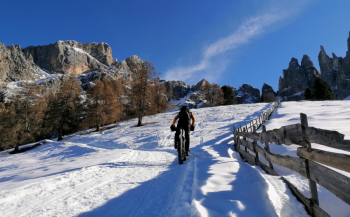
Perfect to do by e-fatbike, but you need to have very good confidence with driving on snow. Not to be done on Sunday because of the presence of many hikers.

You first ride through the Ciamin valley on a nice circular trail, then climb a section on asphalt (if well groomed, you can climb instead of asphalt, on trails 7 or 10) and take the snowy road to the Hanicker hut, with fantastic views of the Torri del Vajolet. Before the hut you take the Torri trail (if beaten), which first ascends and then descends to Nigra Pass.
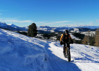
Here you can make a nice circular loop to the Schillerhof. On the way back you tackle the last beautiful snowy descent on the trail to the parking lot.

Challenging but very satisfying itinerary with fantastic views.
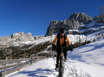
Download our free mobile app to send this route to your Garmin device or to navigate it on OSM maps. Android - iOS
Local weather
Tonight
-8 °C
Tomorrow
2 °C
Tomorrow night
-6 °C
Thursday
5 °C
Thursday night
-4 °C
Friday
6 °C
Friday night
-1 °C
Saturday
5 °C
Saturday night
-2 °C
Sunday
5 °C

Graph

Nearest Routes

2022/08/03
- Italy - Trentino-Alto Adige/Südtirol, BZ
steve-U
(23)
26,36 km
Km
+1 245 mt
Vertical meters
Route difficulty
Landscapes
2023/02/26
- Italy - Trentino-Alto Adige/Südtirol, BZ
nonnocarb
(292)
21,93 km
Km
+1 002 mt
Vertical meters
Route difficulty
Landscapes
2023/03/04
- Italy - Trentino-Alto Adige/Südtirol, BZ
nonnocarb
(292)
50,79 km
Km
+1 800 mt
Vertical meters
Route difficulty
Landscapes
2022/10/22
- Italy - Trentino-Alto Adige/Südtirol, BZ
nonnocarb
(292)
39,26 km
Km
+1 886 mt
Vertical meters
Route difficulty
Landscapes
2023/02/26
- Italy - Trentino-Alto Adige/Südtirol, BZ
nonnocarb
(292)
38,20 km
Km
+1 601 mt
Vertical meters
Route difficulty
Landscapes
2023/02/26
- Italy - Trentino-Alto Adige/Südtirol, BZ
nonnocarb
(292)
36,49 km
Km
+1 550 mt
Vertical meters
Route difficulty
Landscapes
2023/03/07
- Italy - Trentino-Alto Adige/Südtirol, BZ
nonnocarb
(292)
36,18 km
Km
+1 590 mt
Vertical meters
Route difficulty
Landscapes
2022/09/19
- Italy - Trentino-Alto Adige/Südtirol, BZ
37,99 km
Km
+1 851 mt
Vertical meters
Route difficulty
Landscapes
2023/02/26
- Italy - Trentino-Alto Adige/Südtirol, BZ
nonnocarb
(292)
38,74 km
Km
+1 130 mt
Vertical meters
Route difficulty
Landscapes
2023/03/06
- Italy - Trentino-Alto Adige/Südtirol, BZ
nonnocarb
(292)
70,00 km
Km
+2 200 mt
Vertical meters
Route difficulty
Landscapes

0 Comments