HOME RANKINGS CHALLENGES ROUTES POI PLANNING SEARCH LOGIN
Italy - Trentino-Alto Adige/Südtirol, BZ
2023/02/26 12:03:43

Alpe di Siusi sulla neve in senso orario

10 Downloads
0
 
Author
nonnocarb
(266)
Place
Italy - Trentino-Alto Adige/Südtirol, BZ
Km
36,49 km
Elapsed time
04:31:26
Vertical meters
+1 550 mt (984 - 2088)
Route difficulty
Landscapes
Last update
2023/12/04 13:52:51
Comments
0
Description

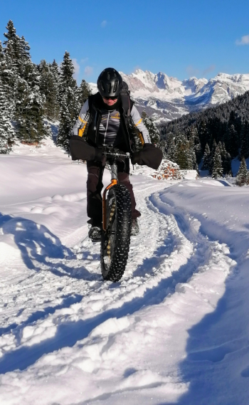
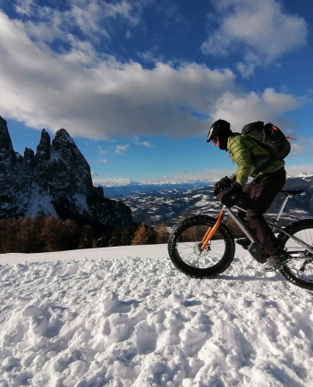
Fantastic route to do on the #snow (but can also be done in summer with small variations), very scenic and fun. Do it a couple of days after the last snowfall, so that the hiking trails are well groomed.

Can be done either by fat bike or e-bike plus, in the latter case better to wait a few more days after the snowfall so that the snow is well settled. Best to choose a sunny day, because the views are fantastic and unmissable. If you don't want to do the first asphalt ascent (with little traffic because the road has limited traffic), you can go up by gondola taking your bike with you.

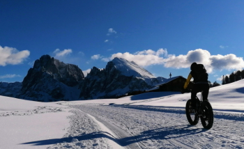
When you reach Compaccio, take the snowy path to Bullaccia, with a nice descent. From here you go up to the Zallinger hut (road not always groomed) and descend by the same. Then go up to the Molignon hut and back toward Compaccio. You turn left and arrive at the Panorama hut. From here you can either descend directly to Compaccio or, as per the trail, continue left with beautiful views of the Schlern to Spitzbuhel. From here you descend on a snow-covered road to the start of the chairlift and then take the beautiful forest trail, usually snow-covered and beaten by ski mountaineers, to the parking lot. (This last trail is challenging, eventully you can descend on the road).

Download our free mobile app to send this route to your Garmin device or to navigate it on OSM maps. Android - iOS

Graph

Nearest Routes

2023/03/04
- Italy - Trentino-Alto Adige/Südtirol, BZ
nonnocarb
(266)
50,79 km
Km
+1 800 mt
Vertical meters
Route difficulty
Landscapes
2022/10/22
- Italy - Trentino-Alto Adige/Südtirol, BZ
nonnocarb
(266)
39,26 km
Km
+1 886 mt
Vertical meters
Route difficulty
Landscapes
2023/02/26
- Italy - Trentino-Alto Adige/Südtirol, BZ
nonnocarb
(266)
38,20 km
Km
+1 601 mt
Vertical meters
Route difficulty
Landscapes
2023/03/07
- Italy - Trentino-Alto Adige/Südtirol, BZ
nonnocarb
(266)
36,18 km
Km
+1 590 mt
Vertical meters
Route difficulty
Landscapes
2022/09/19
- Italy - Trentino-Alto Adige/Südtirol, BZ
37,99 km
Km
+1 851 mt
Vertical meters
Route difficulty
Landscapes
2023/02/26
- Italy - Trentino-Alto Adige/Südtirol, BZ
nonnocarb
(266)
39,56 km
Km
+1 700 mt
Vertical meters
Route difficulty
Landscapes
2023/03/06
- Italy - Trentino-Alto Adige/Südtirol, BZ
nonnocarb
(266)
70,00 km
Km
+2 200 mt
Vertical meters
Route difficulty
Landscapes
2022/08/03
- Italy - Trentino-Alto Adige/Südtirol, BZ
steve-U
(21)
26,36 km
Km
+1 245 mt
Vertical meters
Route difficulty
Landscapes
2023/03/07
- Italy - Trentino-Alto Adige/Südtirol, BZ
nonnocarb
(266)
52,68 km
Km
+1 700 mt
Vertical meters
Route difficulty
Landscapes
2023/02/26
- Italy - Trentino-Alto Adige/Südtirol, BZ
nonnocarb
(266)
21,93 km
Km
+1 002 mt
Vertical meters
Route difficulty
Landscapes

0 Comments