HOME RANKINGS CHALLENGES ROUTES NEAR ME PLANNING SEARCH LOGIN
Italy - Trentino-Alto Adige/Südtirol, BZ
2023/03/07 21:57:12

Intorno al Bullaccia

29 Downloads
1
 
Share

Key Takeaways / Scheda Tecnica

Disciplina:
Mountain Bike (MTB)
Percorso:
Intorno al Bullaccia
Località:
Italy - Trentino-Alto Adige/Südtirol, BZ
Distanza:
36,18 km
Dislivello Positivo:
+1 590 mt (Quota Min: 1023m - Max: 2172m)
Difficoltà Tecnica:
5/5
Valutazione Panorami:
5/5
Formato Traccia:
GPX Download disponibile
Author
nonnocarb
(324)
Place
Italy - Trentino-Alto Adige/Südtirol, BZ
Km
36,18 km
Elapsed time
05:50:54
Vertical meters
+1 590 mt (1023 - 2172)
Route difficulty
Landscapes
Last update
2023/03/09 09:04:28
Comments
0
Description

This is a very challenging route but, for those with excellent descent technique, also a lot of fun. The views are exceptional.

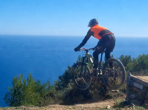
Foto itinerario MTB Intorno al Bullaccia - Italy - Trentino-Alto Adige/Südtirol, BZ

From Siusi you go up to the Alpe on secondary roads, then take a nice path up and down to S. Michele. From the Pinei Pass you descend briefly on asphalt and climb to Bulla, a delightful little village. In the narrow valley you climb and arrive at the Siusi Alp and from there to Bullaccia with a very steep climb.

Foto itinerario MTB Intorno al Bullaccia - Italy - Trentino-Alto Adige/Südtirol, BZ

You turn the beautiful path around the mountain, with splendid views, and then descend on path 8, initially doable, then very technical with several sections to be done on foot. After a giant old landslide, in the woods you quickly descend to Tiosels. From here you ascend slightly, with beautiful views of the Schlern, and return to Siusi

Foto itinerario MTB Intorno al Bullaccia - Italy - Trentino-Alto Adige/Südtirol, BZ

Download our free mobile app to send this route to your Garmin device or to navigate it on OSM maps. Android - iOS
Local weather
Tue 00:00
10 °C
Tue 12:00
11 °C
Wed 00:00
11 °C
Wed 12:00
12 °C
Thu 00:00
9 °C
Thu 12:00
9 °C
Fri 00:00
4 °C
Fri 12:00
8 °C
Sat 00:00
5 °C
Sat 12:00
5 °C

Graph

Nearest Routes

2023/02/26
- Italy - Trentino-Alto Adige/Südtirol, BZ
nonnocarb
(324)
36,49 km
Km
+1 550 mt
Vertical meters
Route difficulty
Landscapes
2023/02/26
- Italy - Trentino-Alto Adige/Südtirol, BZ
nonnocarb
(324)
38,20 km
Km
+1 601 mt
Vertical meters
Route difficulty
Landscapes
2022/10/22
- Italy - Trentino-Alto Adige/Südtirol, BZ
nonnocarb
(324)
39,26 km
Km
+1 886 mt
Vertical meters
Route difficulty
Landscapes
2023/03/04
- Italy - Trentino-Alto Adige/Südtirol, BZ
nonnocarb
(324)
50,79 km
Km
+1 800 mt
Vertical meters
Route difficulty
Landscapes
2022/09/19
- Italy - Trentino-Alto Adige/Südtirol, BZ
37,99 km
Km
+1 851 mt
Vertical meters
Route difficulty
Landscapes
2024/05/27
- Italy - Trentino-Alto Adige/Südtirol, BZ
nonnocarb
(324)
68,82 km
Km
+2 300 mt
Vertical meters
Route difficulty
Landscapes
2023/02/26
- Italy - Trentino-Alto Adige/Südtirol, BZ
nonnocarb
(324)
39,56 km
Km
+1 700 mt
Vertical meters
Route difficulty
Landscapes
2023/03/06
- Italy - Trentino-Alto Adige/Südtirol, BZ
nonnocarb
(324)
70,00 km
Km
+2 200 mt
Vertical meters
Route difficulty
Landscapes
2023/03/07
- Italy - Trentino-Alto Adige/Südtirol, BZ
nonnocarb
(324)
52,68 km
Km
+1 700 mt
Vertical meters
Route difficulty
Landscapes
2022/08/03
- Italy - Trentino-Alto Adige/Südtirol, BZ
steve-U
(29)
26,36 km
Km
+1 245 mt
Vertical meters
Route difficulty
Landscapes

0 Comments