
 Italiano
 Deutsch
Grione Malgalonga Ranzanico

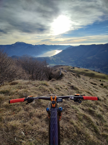
Start from Ranzanico, climb on asphalt on roads with little to no traffic, with comfortable slopes and lake views, to the Ranzanico fork. Continue and the road becomes a dirt carrale that in the proposed track also takes you to Madonna del pizzo (short A/R section) the track continues and passing under the sparavera but if you want you can climb to the cross (about 170 m D+, part of which you have to push, following this track). You continue to the Grione ridge trail, an up and down, not particularly displaced with a few short technical passages that still deserve some attention. After a nice steep climb (S3) you arrive at the Cross.
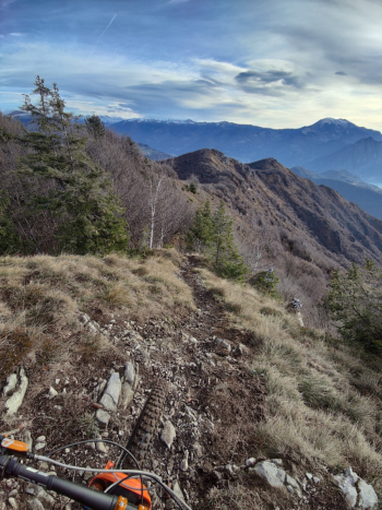
The trail continues on the ridge trail and becomes less and less technical (alternatively you can save 180m of elevation gain by following this trail)
We climb up from a road with challenging inclines and then connect afterwards at a meadow to the 13 valleys trail; a nice eat and drink in the woods (beautiful in Emtb, challenging in Mtb) that comes out just below the Malgalonga refuge (often open). From the Malgalonga we continue on the road and then deviate to a not very beaten track and with gps in hand we return to the beginning of the ridge trail from which we will take the descent that will lead to Endine. The first part very nice, is a S2 with some technical S3 passages.
The second part (elevation 950m) is taken to the right of the farmstead and is a path is midhill with several ups and downs, never too technical, a bit closed by vegetation.
As an alternative to the second part, it is possible to descend to the south by a slightly longer but albeit enjoyable descent, unfortunately rocked by the passage of motorcycles
Trail style: Trail/AM
Personal rating: views 9/10; descents 7/10
MTB: yes
EMTB: yes
Duration about 4.5h (in Emtb)
Thrust: some sections
Difficulty ascent: always well manageable
Difficulty descent: S1/S2 some passages S3
Exposed: not particularly exposed
Drainage: not tested but the terrain inspires me well


