
 Italiano
 Deutsch
Pointe Fine - L'esposizione è servita!

Physically undemanding but extremely exposed cyclo-mountaineering, suitable only for those familiar with alpine environments.
Departing from Jaunsier, just lift your head and see your destination immediately! Following the track we detach ourselves from the road to go to take a nice parallel path that then goes to join the dirt road that climbs to Le Clausard and then to the alpine pasture at the beginning of the vallone de Bachasse closed by the tete de Fin Fond. We point straight to the head of the valley and after a hundred meters still pedaling the bike switches to shoulder or push bikes.
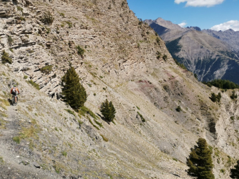
About at an altitude of 2400 m we spot a small side valley that takes us to the beautiful scree ridge near the pass from which the view of the entire Ubaye valley is remarkable!
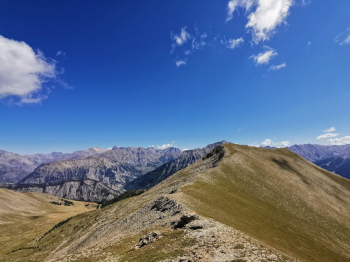
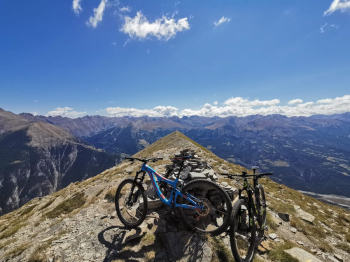
We follow the beautiful ridge until we reach the very panoramic summit of Point Fine overlooking Jaunsier. Hard to believe you can pass under there...yet!!!
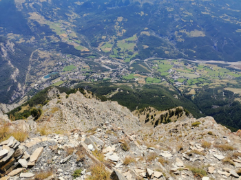
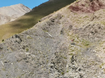
From the summit we follow the trail that incredibly descends into the valley and goes to intercept Le Chemin Horizontal near the Cabane de Costebelle. The trail to the west has almost disappeared, obliterated by the avalanches, we follow it to the east Start here a truly incredible section, a super aerial traverse on a path barely as narrow as the bike, easy but where it is forbidden to fall!
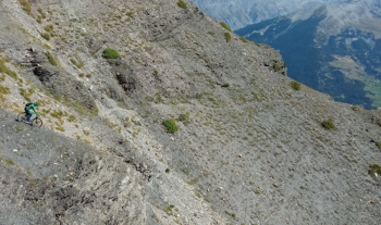
Finished the traverse with the dry gorge we start a superlative descent through the pine forest with a series of really beautiful hairpin bends! Near a shoulder at an altitude of 1900 we leave the path that continues in traverse to take one that pulls straight down the valley, the most technical section begins with some challenging passages until we reach a ramp to be tackled on foot that descends on a stream.
On the other side in short we are on the dirt road that we follow until the fork, we climb for less than 100 mt d+ , the road becomes a flat path, past a creek we follow in path on the right that descends, at first not very evident, then enters the woods with a series of steep but beautiful hairpin bends until we arrive again to a creek that we follow until the village.