
 Italiano
 Deutsch
M. Bersaio

Impossible to pass on the Colle della Maddalena highway without being captured by the dolomite wall of M. Bersaio Thanks to the maintenance of the trails by the City of Sambuco, the whole area is full of possibilities of all kinds.
The Bersaio loop is a super classic with a long climb on dirt but with a really nice final descent that is always well maintained, here instead we aim for the summit to add a dash of cyclo-mountaineering and to try to stay on trail for much of the climb and then rejoin the beautiful Vallone della Madonna trail (in name and in fact!) on the descent.
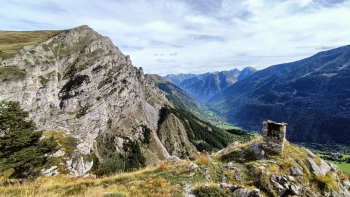
From the village we start immediately on indigestible inclines to go intercept the Borgate Trail that passes higher and connects Serre Bianco with Moriglione via idyllic flat trail. Once on the dirt road of Colle Bandia, all that remains is to climb up to Pilone, a vantage point from which there are magnificent views of the valley and our summit.
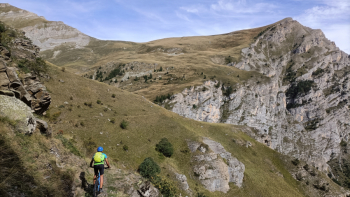
We continue to climb a few hundred meters and take a path (signposted M.Bersaio) that descends a few hairpin bends and then enters the valley with a beautiful traverse that is almost all cyclable.
Near the creek the path is rougher and less obvious, we keep to the left looking for the best lines to pedal as much as possible, but short stretches are to be pushed, then crossing the creek we go to intercept a very bumpy dirt road (this stretch is often very wet and muddy). Following some tracks we cut the slope below the dirt road to pick it up a little further on and follow it a few hundred meters to its end.
We now follow the trail markers, which incredibly, if we follow the right tracks, allow us to pedal most of the way up to Colle Piconiera. From the Col we aim for the obvious summit by following the ridge or staying slightly east side but practically always pedaling until below the summit pyramid to be reached with a very short section with a backpacking bike.
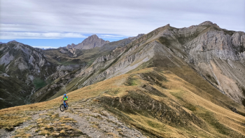
From the summit Sambuco is plumb line.
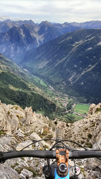
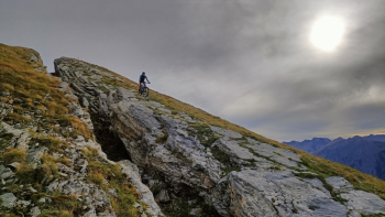
We descend the limestone slabs and then backtrack a section of ridge and then bend right following the path that is a bit friable in this section.
After a traverse with short exposed sections we enter the final descent of the Vallone della Madonna! Towards the end you can go straight ahead to get straight to the village without complications, but if you still feel like exploring, turn right on the Borgate trail that forces at the beginning a very short pushing section, then continues very nice to then descend on the dirt road that leads to the village.
All that remains is to enjoy a well-deserved snack or dinner at the Locanda della Pace, the valley's landmark for skialers and mtb riders!