Italiano
 Deutsch
Palazzuolo sul Senio: Ocarello e Prevaligo

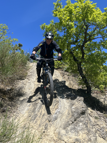
Start from the upper parking lot in Palazzuolo. After leaving the parking lot, take Provincial Road 477 westward; once you’ve left the village, continue straight ahead at the fork toward the Paretaio Pass. The climb on paved road is long but gradual. Upon reaching the pass, after a short, gentle descent, take a dirt road to the left that climbs steeply and then levels off. The route alternates between sections of moderate and gentle inclines and steep climbs; the surface consists of dirt, stones, and rock, and in the flatter areas there is a risk of mud during rainy periods. After passing Poggio della Celestina, you reach Poggio del Budrio, where you take a trail to the left (unmarked, with only a few blue markers). The single track then proceeds with a very smooth flow and moderate gradient over a surface of dirt, grass, and rock, featuring a few simple technical sections followed by another nice flow with fast, tight turns and the occasional short climb. There are also some more technical sections.
You pass the village of Ocarello on your lower right, and after a flat stretch followed by a gentle climb, you reach Mount Mandriole. Here, you leave the classic trail (which descends onto a dirt road and then across a large meadow toward the ruins of the Mandriole farmhouse) and turn left. A guided ridge section begins through the trees, leading to a fork: to the right is the Mandriole 1 trail, short but tough and steep. To the left is the Mandriole 2 variant, also short but easier (though it too has a steep section). The final stretch along a small ridge with rocky terrain is shared; it’s somewhat exposed on the left but less challenging than the initial section. You’ll rejoin the classic Ocarello trail.
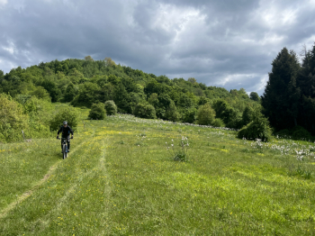
A short climb toward Poggio Cherubino. Here we took the trail on the right that climbs and then a slightly descending traverse to rejoin the trail (which has a fallen tree to climb over). Leaving the hill, the single track continues smoothly (just a short climb); you pass around a field of solar panels and arrive at a house, take the trail to the right, and after another stretch of single track, you reach some old houses and descend a few steps (low steps) until you reach the road just outside Palazzuolo. Here, turn right toward the Sambuca Pass.
After passing Quadalto, keep left and climb toward Ca di Piraccio/Cambè, then continue toward Lozzole. First a gradual climb on asphalt, a steep stretch on concrete, and then several more steep sections on dirt. Once in Lozzole, turn left; after a few more tough climbs, just before reaching Monte Prevalico, take the trail on the left that descends to Palazzuolo. A fast-flowing trail but with stones and boulders, alternating between flowing sections and technical passages bordering on trial-style riding. In the final section, there are a few alternatives to reach the parking lot directly.
Difficulty: S4