Italiano
 Deutsch
Mount Trevine
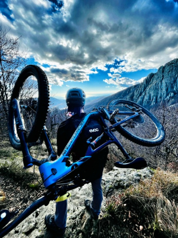
Tough ride with lots of portage suitable for lovers of the genre.
Start from Santa Maria del Taro, climb on asphalt and then veer to the RIGHT on a dirt road to the Griffi Pass.
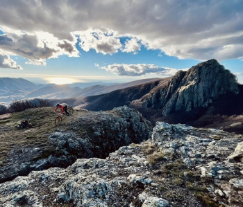
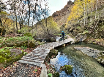
Wetake the Alta Via always uphill through a forest, at first rideable and then hardening and consequently turning the backpack into a bike rack up to Monte Griffi, where we round the summit and descend to a meadow; continue on the Alta Via on a path carved into the rock in places, beautiful, up to Scaletta Pass. We pass the little gate and with a narrow traverse we come to small waterfalls, cross a small bridge and reload the bike for another portage section; we ascend again, skirting the stream in a gorge that, as we ascend, opens more and more.
We put the bike down because having reached the beech groves we now pedal; the trail takes us comfortably, or almost comfortably, up to the Porcelletti Pass; we follow for the Incisa Pass with some walking and a final snatch.
We descend to the Casermette del Penna barracks on dirt road and trail, put our wheels on asphalt, and uphill we reach the Chiodo Pass. A forestry road takes us to the Nave del Penna, which awaits us for the penultimate stretch of portage that lasts until the junction to Mount Penna. Here we climb into the saddle and enjoy this up-and-down trail while it lasts--and it lasts only a short time.... we reload the bike on our backs for a short distance; we find a rock bottleneck to cross and here is the summit of Trevine!!!
Panoramic summit with a special view of Mount Penna, beautifulooo!!!
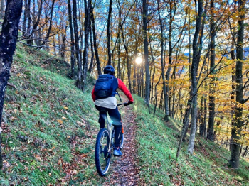
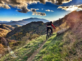
Now begins the descent into the beech forest, very flowing and fast; arrived at the Faggio dei Tre Comuni hut, we throw ourselves on a pedaled and fast path; at the first evident fork we keep the RIGHT; still fast path that arrives on a forestry road. We ride along it for a short distance, to take a dirt road to the RIGHT that soon becomes a path and off down a sheer drop. Watch out because it is not marked and with the carpet of leaves you can hardly see it.
At the end of the trail we find a forestry road again, cross it and drop down on a last stretch of trail before the Taro dam ; cross it and turn left on forestry to the fork, where we take a path to the RIGHT halfway up the hillside toward the piezometric station.
We then descend until we reach again the forest road leading to the Case Mazzi hamlet; we walk along its narrow streets and leave it to enter a narrow valley.
The path is on an old water transport route, a little worn and sometimes patched; we cross the stream (the newly born Taro...) and climb for a stretch the forest: now begins a stupendous traverse in a chestnut forest, all to be pedaled carefully because it is exposed and narrow in places, beautiful. We enjoy it all the way back to civilization...we pass by the sports field of Santa Maria del Taro and on asphalt we return to the village and the car.