Italiano
 Deutsch
Monte Carmo e Karma trail

Itinerary to Monte Carmo with a more technical and strenuous alternative ascent to the classic Giustenice that you can find here and with a descent on the Karma trail, one of the longest trails in the whole Finale area, beware however that the trail is not always clean, in particular the upper and middle parts being in the woods get dirty easily, so if in doubt inquire first.
For those who want to lengthen the tour and make it more technical, I recommend the descent to Toirano (this one always feasible) that from Rifugio del Carmo you take following the red X trail that joins the M Ravinet and San Pietro nei Monti loop at Ciazzalunga.
The climb described here is designed to try to use as many trails as possible, so those who prefer an easier climb can use several dirt roads, primarily the one that climbs from Giustenice, which can also be intercepted by climbing from Verzi.
Departure just below the Pietra Ligure highway toll booth, go up to Ranzi and continue on a dirt road for a few km and past the junction with the dirt road coming up from Verzi, after about 400 meters you leave the dirt road (continuing on the dirt road you arrive on the Giustenice road), go straight on a wide but rocky and rather technical path, after a while it flattens out with fun trail, then the gps track follows an uphill path for e-bikes which I don't recommend, better to continue straight on a slight descent until you reach a dirt road (coming from Verzi), go up two hairpin bends and at the third one follow the dirt road to the right which in a few hundred meters rejoins the gps track and after another 300 meters arrives at a junction with several paths, at this point continue uphill keeping to the right. Now we are on the Ruota Bella trail that is very fun and always rideable but with short technical tears.
Arrived at Cascina Porro we follow an uphill e-bike trail (ramp) that initially forces you to push, we cross Hiroshima trail (following it downhill you arrive on the Giustenice dirt road), we continue the ascent on the right, unfortunately here several tears are to push but after 100 meters of elevation gain it joins again Hiroshima trail, here you leave out the gps track and keep the right uphill because more pedalable arriving after another 100 meters of elevation gain on a dirt road that just to the right joins the main one that you follow until the Giustenice Pass.
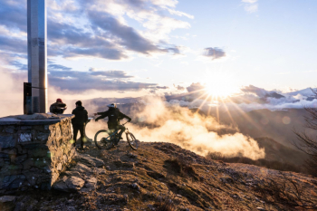
At the pass we follow pedaling the path to the Carmo until a fork, both paths lead to the summit but neither is entirely cyclable, we follow the one on the left immediately with bike on our shoulders that shortly after is cyclable and very scenic. Having reached the meadow below the summit, all that remains is to push up to the very panoramic summit cross.
Back to the meadow we follow towards the Rifugio del Carmo, just before we intercept the Karma Trail on the left that immediately enters the woods, on the right instead begins the X red trail that descends to Toirano
Initially it descends between natural banks without too much difficulty, then towards Rocca dell'Aia it becomes more technical, be careful to follow the trail on the left that makes a traverse and goes alongside a stream (more technical section). Arrived on a dirt road you have to take the terminal part of Karma on the right, in this section the landscape and terrain changes and from forest it becomes Mediterranean scrub with really nice route until Verzi from where you continue on asphalt.