HOME RANKINGS CHALLENGES ROUTES POI PLANNING SEARCH LOGIN
Italy - Emilia-Romagna, PC
2022/11/04 18:08:03

Monte Penna e Prato Cipolla

12 Downloads
0
 
Author
pozzoligio
(87)
Place
Italy - Emilia-Romagna, PC
Km
59,32 km
Elapsed time
06:27:27
Vertical meters
+1 994 mt (827 - 1724)
Route difficulty
Landscapes
Last update
2023/01/03 15:52:36
Comments
0
Description

Challenging route with 2 push sections, one for the summit of Mt Penna and the other a section of the climb to Prato Cipolla, but not long.

Start at Pertuso, immediately steep to the big meadow then right to Zovallo pass on nice dirt road with a steady slope.

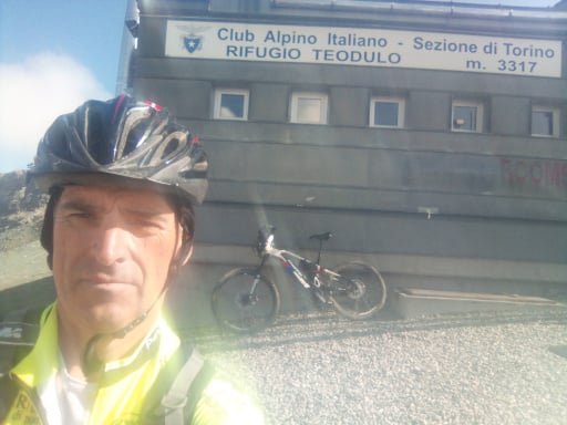
Now asphalt to Tomarlo pass then left to Chiodo pass following CAI trail from side to road, then down to hut nestled in Mt. Penna forest.

Now dirt climb to Incisa pass where the steep trail to the summit begins, with the ebike I pedaled 70% zigzagging through the forest, short final stretch on foot because stony.

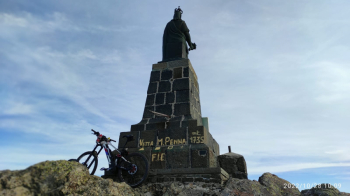
Wonderful view from the 1735 mt summit.

The descent is challenging but all in the saddle except for the first stony bit.

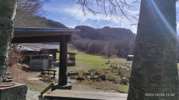
Now left on nice forest road, pass Faggio 3 comuni hut to asphalt, climb to Chiodo pass, then return to tomarlo pass.

At CAI Passo della Lepre sign, go left and follow trail to ski slope.

Now steep push section, 5 minutes on ebike, then continue pedaling to Onion Meadow.

Follow the beautiful trail that comes out at the Lago Nero hotel, really nice and all in the woods, then continue on the challenging cai trail to Selva, marked but not very beaten, then continue on the CAI trail to Pertuso, lots of fords, steep ups and downs and seems never ending, but easy.

Below is a photo of the summit of Mt. Penna and Onion Meadow.

Water can be found at the fountain after Zovallo Pass and at Prato Cipolla.


Download our free mobile app to send this route to your Garmin device or to navigate it on OSM maps. Android - iOS

Graph

Nearest Routes

2024/02/05
- Italy - Emilia-Romagna, PC
pozzoligio
(87)
46,12 km
Km
+1 700 mt
Vertical meters
Route difficulty
Landscapes
2023/03/06
- Italy - Emilia-Romagna, PC
Antosangui
(106)
16,04 km
Km
+473 mt
Vertical meters
Route difficulty
Landscapes
2023/07/30
- Italy - Emilia-Romagna, PC
miciolo
(28)
30,14 km
Km
+1 340 mt
Vertical meters
Route difficulty
Landscapes
2023/04/01
- Italy - Emilia-Romagna, PC
pozzoligio
(87)
49,83 km
Km
+2 100 mt
Vertical meters
Route difficulty
Landscapes
2023/10/23
- Italy - Emilia-Romagna, PC
miciolo
(28)
31,87 km
Km
+1 130 mt
Vertical meters
Route difficulty
Landscapes
2023/03/07
- Italy - Emilia-Romagna, PC
Antosangui
(106)
8,87 km
Km
+479 mt
Vertical meters
Route difficulty
Landscapes
2023/02/28
- Italy - Liguria, GE
Antosangui
(106)
39,07 km
Km
+750 mt
Vertical meters
Route difficulty
Landscapes
2022/11/07
- Italy - Emilia-Romagna, PC
pozzoligio
(87)
58,83 km
Km
+2 161 mt
Vertical meters
Route difficulty
Landscapes
2023/02/24
- Italy - Liguria, GE
Antosangui
(106)
24,39 km
Km
+1 172 mt
Vertical meters
Route difficulty
Landscapes
2023/03/06
- Italy - Liguria, GE
Antosangui
(106)
7,02 km
Km
+392 mt
Vertical meters
Route difficulty
Landscapes

0 Comments