Italiano
 Deutsch
Laghi morenici Alta Valnure (PC)

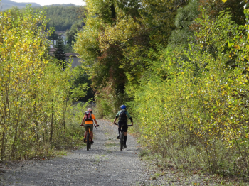
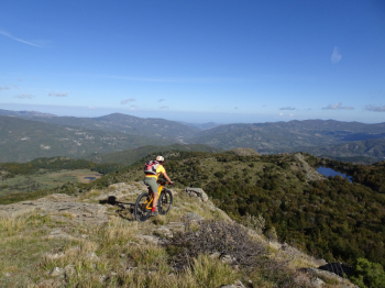
All Mountain tour starting from the square in front of the Church of Ferriere, which is an hour's drive from Piacenza along the Val Nure state road. On asphalt we pass the villages of Canadello and Rocconi until we take the detour to Pertuso. At a hairpin bend to the right we take a dirt road that with hard ramps will take us to Pian Meghino above the village of Pertuso. Now 500 linear meters of asphalt and nice dirt road up to the 1400 mt of Prato Grande.
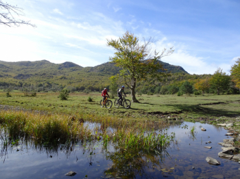
In the trail there is a short A/R on Mount Roccone, one of the few places from where we will be able to see Lake Bino and Lake Moo together. To climb Roccone there is no trail, so if the cycling spirit prevails in you over the hiking spirit, do not take this detour. The dirt road down to Lake Bino, which is a short detour to the right, has a loose rocky surface. Upstream from the lake, about 50 meters from a table with benches, following the tributary you will also find a source of very fresh water.
Return to the stony dirt road for a very short distance until you take a technical trail on the left that descends to the Lake Moo plain. This is the only technical section of the tour that can be bypassed by continuing down the dirt road.
Lake Moo is only visible from above, so don't try to approach from the meadow because you'll take a big risk. It is a cinch to get bogged down in the marsh. Also in this section we find another spring near wooden footbridges in a meadow. We pass the Lake outfall and reconnect with the dirt road. Now downhill, with a few short relaunches, to Fontana Rosa and down to the Church of San Gregorio. On asphalt with zero traffic we reach the hamlet of Tomè and on a little beaten track the hamlet of Toni.
Crossing a meadow you reach the state highway near the village of Perotti. If the Nure is high or if the ford has been washed away by some floods I suggest you close the tour on asphalt, it is a short distance to Ferriere. Otherwise at Perotti go down along the Nure on smooth dirt road and face the ford. A few meters and you are at the cars.
However before embarking on this route read the photoreport to get an idea of the hike.