HOME RANKINGS CHALLENGES ROUTES NEAR ME PLANNING SEARCH LOGIN
Italy - Piemonte, TO
2022/11/01 21:15:55

Bassa Val Susa - sent.558

3 Downloads
3
 
Share
Author
gmzolenart
(115)
Place
Italy - Piemonte, TO
Km
21,50 km
Elapsed time
04:39:25
Vertical meters
+1 291 mt (498 - 1736)
Route difficulty
Landscapes
Last update
2025/05/17 11:44:33
Comments
0
Description

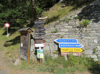
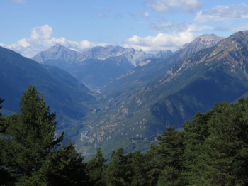
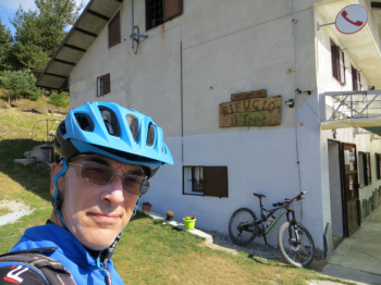
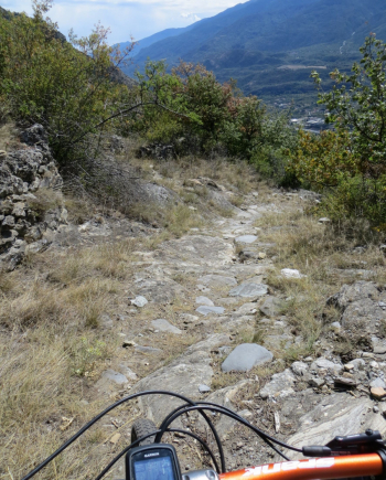
Start in Susa following the signs for Rifugio La Riposa and Rocciamelone. At Mompantero you can opt for the variant to the west Seghino and Borgata Periere, to take the wider dirt road back to Rifugio La Riposa. As you ascend there are some glimpses of the valley (photo) such as the Exilles and Chaberton fort. Conversely, the vegetation is ghostly due to the extensive fire that broke out in October 2017. Arriving at Alpe Prariondetto, elevation 1750 meters, we descend to the right for a few hundred meters to Borgata Il Trucco elevation 1700 meters.

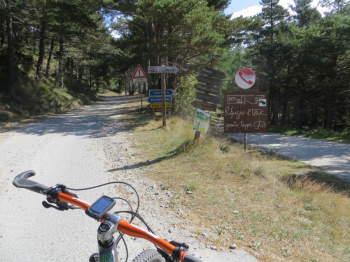
At the entrance to the refreshment area, a trail starts with a signpost that after a few meters indicates trail 558 on the left. This is a narrow mule track of mostly fixed stones that leads to Seghino. From here by the uphill road you return to Susa.


Download our free mobile app to send this route to your Garmin device or to navigate it on OSM maps. Android - iOS
Local weather
°C
°C
°C
°C
°C
°C
°C
°C
°C
°C

Graph

Nearest Routes

2024/05/24
- Italy - Piemonte, TO
BAROLO71
(34)
16,06 km
Km
+880 mt
Vertical meters
Route difficulty
Landscapes
18,22 km
Km
+1 002 mt
Vertical meters
Route difficulty
Landscapes
2023/03/08
- Italy - Piemonte, TO
gmzolenart
(115)
20,07 km
Km
+1 191 mt
Vertical meters
Route difficulty
Landscapes
2022/09/02
- Italy - Piemonte, TO
paiogs
(12)
36,72 km
Km
+2 900 mt
Vertical meters
Route difficulty
Landscapes
2022/09/09
- Italy - Piemonte, TO
gmzolenart
(115)
22,83 km
Km
+1 113 mt
Vertical meters
Route difficulty
Landscapes
2022/09/09
- Italy - Piemonte, TO
gmzolenart
(115)
25,74 km
Km
+1 019 mt
Vertical meters
Route difficulty
Landscapes
2023/10/06
- Italy - Piemonte, TO
pozzoligio
(93)
54,43 km
Km
+2 160 mt
Vertical meters
Route difficulty
Landscapes
2022/09/26
- Italy - Piemonte, TO
pozzoligio
(93)
81,05 km
Km
+2 758 mt
Vertical meters
Route difficulty
Landscapes
2023/05/31
- Italy - Piemonte, TO
ant1606
(1)
56,49 km
Km
+1 450 mt
Vertical meters
Route difficulty
Landscapes
2024/05/23
- Italy - Piemonte, TO
24,86 km
Km
+1 140 mt
Vertical meters
Route difficulty
Landscapes

0 Comments