2022/10/28 09:00:52
Adige Valley
Author
Place
Italy - Trentino-Alto Adige/Südtirol, BZ
Km
52,87 km
Elapsed time
04:53:11
Vertical meters
+1 754 mt (243 - 954)
Route difficulty
Landscapes
Last update
2022/10/28 09:16:26
Comments
Description
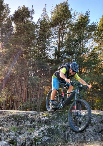
This is a very challenging route, both for the technical descents, but especially for the very steep and unevenly paved climbs.
Therefore, if done by regular bike it requires a lot of training and several stretches where you have to push the bike, if done by ebike you can ride almost completely, provided you have good riding technique.

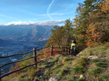
The route follows as much as possible mule tracks, paths and forest roads on both sides of the Adige Valley, from Merano to Nalles. Going on the right orographic side and returning on the left.

It is a continuous up and down of almost 2,000 meters, so in addition to good technique, good training is required. In return you will enjoy beautiful views of the valley, castles, lakes, forests and other natural sites.
Local weather
Today

23 °C
Tonight

15 °C
Tomorrow

21 °C
Tomorrow night

11 °C
Wednesday

25 °C
Wednesday night

14 °C
Graph
Nearest Routes
61,03 km
Km
+2 156 mt
Vertical meters
Route difficulty
Landscapes
65,11 km
Km
+1 800 mt
Vertical meters
Route difficulty
Landscapes
29,33 km
Km
+1 650 mt
Vertical meters
Route difficulty
Landscapes
58,50 km
Km
+1 370 mt
Vertical meters
Route difficulty
Landscapes
2023/03/04
- Italy - Trentino-Alto Adige/Südtirol, BZ 58,93 km
Km
+3 000 mt
Vertical meters
Route difficulty
Landscapes
85,71 km
Km
+2 730 mt
Vertical meters
Route difficulty
Landscapes
64,32 km
Km
+2 400 mt
Vertical meters
Route difficulty
Landscapes
33,38 km
Km
+1 600 mt
Vertical meters
Route difficulty
Landscapes
2024/09/18
- Italy - Trentino-Alto Adige/Südtirol, BZ 59,35 km
Km
+3 050 mt
Vertical meters
Route difficulty
Landscapes
94,24 km
Km
+2 400 mt
Vertical meters
Route difficulty
Landscapes


 Italiano
 Deutsch
