Italiano
 Deutsch
Massa Marittima: doppietta tra il Canyon e Monte Arsenti
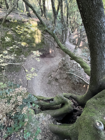
A great combination of trail areas—the one that connects the trails of Canyon and Monte Arsenti—for a day of riding through singletrack, natural canyons, and thrilling descents. The route starts in Massa Marittima, following the pleasant CAI 33 bike trail, which heads toward Poggio Ventura with some fun ups and downs. From here, take an old downhill trail that leads to Capanne. After crossing the paved road, you’ll gain elevation along the CAI 35 forest road, then leave it behind and continue up a single-track climb (which runs alongside Canyon 2, currently closed)—an easy ride—that leads all the way to Poggio Salcerini. Here, follow the signs for Canyon 1, one of the area’s absolute must-ride trails. The trail is truly one-of-a-kind: it winds through a canyon carved out by a stream and offers an extremely flowing descent, characterized by a succession of hairpin turns and wall rides that almost make you feel like you’re on a bobsled track. There’s no shortage of jumps and a few more technical sections, but the pace remains consistently fast, making for a quick and fun ride (S2).
Once the descent is over, you head back up along the trail that runs alongside the canyon: an overall rideable climb, with a final stretch that’s decidedly steeper. Once you reach the plateau again, turn right to gain more elevation and take the connecting trail toward Serrabottini/Val di Strega. Here, another smooth trail (S2) awaits, featuring a nice sequence of hairpin turns and a few technical sections that pleasantly break up the flow. At the end of the descent, keep left and climb back up toward Poggio Tondo, crossing the Cimone area. You’ll initially continue on a dirt road until you reach the Padre Pio trail (S1/S2): a fast and fun route, interspersed with more technical sections, hairpin turns, and a few jumps. It’s a varied descent that alternates between stretches where you can let it rip and sections that require more precise riding.
You then begin climbing again along a beautiful, easily rideable singletrack (Sex Uphill) that takes you back to Poggio Tondo. From here, take the Pesta/Carpignone trail, which descends to the hamlet of Pesta. The first part is more technical and requires a bit of attention, while the second opens up into a much more flowing section, ideal for letting the bike glide. Once you arrive in Pesta, it’s worth taking a short detour to admire the picturesque Accesa Lake, a scenic interlude that’s definitely worth a stop. You then set off again, tackling a new climb—initially on a dirt road and later on a single track—until you reach Poggio Salcerini once more. At this point, there’s no doubt about it: Canyon 1 is definitely worth a second run! You then retrace the trail before turning onto the paved road toward Massa Marittima.
At a roundabout, turn onto a small side road leading to Podere Cicalino. From here, the final part of the route begins: you climb along a narrow road and then a forest road until you reach the mountain hut. Once there, you enter the Monte Arsenti area, where—to round out the day in style—a descent on the Gambler (S1/S2) is a must. Once you’ve finished the trail and reached the dirt road, take the return route toward Massa Marittima, making use of a network of secondary roads and bike paths.
A truly well-rounded day, featuring two distinct yet perfectly complementary riding areas, plenty of trails to explore, and a great mix of rideable climbs, technical descents, and super-flow sections. The Massa Marittima area proves to be a veritable treasure trove of singletrack: Canyon 1 alone is worth the trip!