HOME RANKINGS CHALLENGES ROUTES NEAR ME PLANNING SEARCH LOGIN
Italy - Friuli-Venezia Giulia, UD
2026/10/26 09:46:47

Verzegnis - Monte Alt - Stavoli Chiampomano

1 Downloads
0
 
Share

Key Takeaways / Scheda Tecnica

Disciplina:
Mountain Bike (MTB)
Percorso:
Verzegnis - Monte Alt - Stavoli Chiampomano
Place:
Italy - Friuli-Venezia Giulia, UD
Km:
16,68 km
Vertical meters:
+800 mt (Quota Min: 469m - Max: 736m)
Route difficulty:
3/5
Landscapes:
3/5
Formato Traccia:
GPX Download disponibile
Author
matiuc
(9)
Place
Italy - Friuli-Venezia Giulia, UD
Km
16,68 km
Elapsed time
02:08:12
Vertical meters
+800 mt (469 - 736)
Route difficulty
Landscapes
Last update
2026/10/26 10:43:41
Comments
0
Description

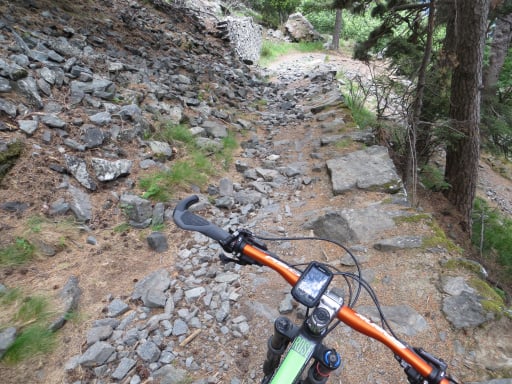
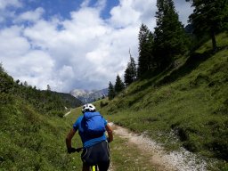
The route starts in Chiaicis, at the parking lot next to the road. Follow the signs for Lake Verzegnis: a short, steep descent, a bridge over the lake, and a steep paved climb. Once you reach the top of the hill, continue straight ahead on the paved road at the intersection, then follow the hairpin turn to the left downhill. As the climb resumes, the road becomes a dirt road; after an initial section that has been maintained, it turns into a rough, overgrown mule track. When you reach the summit of Monte Alz, you can no longer continue on this route; instead, take a trail that climbs a few meters into the woods on the left. Ride a short flat section, and then the S1/S2 single-track trail begins deep in the woods—unmarked on maps but mostly rideable.

You’ll emerge onto the paved road taken on the way there and head back up to the first intersection. Here, turn left, still on asphalt, and climb toward the Verzegnis-Sella Chianzutan provincial road; descend along it until just past a hairpin turn, then take the small paved road on the left toward Stavolo Chiampomano. Ride on asphalt up a steep incline through the woods to Stavolo, then continue on the dirt road to the left and descend back onto the asphalt. You’ll rejoin the descent from Sella Chianzutan near Chiaicis, and after 1 km, you can give your legs a rest.

20% paved–80% dirt, moderately challenging, single track S1/S2.

Download our free mobile app to send this route to your Garmin device or to navigate it on OSM maps. Android - iOS
Local weather
Mon 00:00
6 °C
Mon 12:00
9 °C
Tue 00:00
6 °C
Tue 12:00
10 °C
Wed 00:00
9 °C
Wed 12:00
11 °C
Thu 00:00
8 °C
Thu 12:00
11 °C
Fri 00:00
10 °C
Fri 12:00
14 °C

Graph

Nearest Routes

2024/08/16
- Italy - Friuli-Venezia Giulia, UD
gmzolenart
(137)
18,20 km
Km
+815 mt
Vertical meters
Route difficulty
Landscapes
2022/08/04
- Italy - Friuli-Venezia Giulia, UD
gmzolenart
(137)
32,17 km
Km
+1 900 mt
Vertical meters
Route difficulty
Landscapes
2023/03/07
- Italy - Friuli-Venezia Giulia, UD
civi65
(106)
15,87 km
Km
+1 000 mt
Vertical meters
Route difficulty
Landscapes
2023/10/22
- Italy - Friuli-Venezia Giulia, UD
debonafr
(18)
15,68 km
Km
+800 mt
Vertical meters
Route difficulty
Landscapes
2024/03/25
- Italy - Friuli-Venezia Giulia, UD
civi65
(106)
31,05 km
Km
+1 700 mt
Vertical meters
Route difficulty
Landscapes
2024/11/15
- Italy - Friuli-Venezia Giulia, UD
civi65
(106)
29,53 km
Km
+1 600 mt
Vertical meters
Route difficulty
Landscapes
2023/03/06
- Italy - Friuli-Venezia Giulia, UD
civi65
(106)
25,54 km
Km
+1 000 mt
Vertical meters
Route difficulty
Landscapes
2022/09/07
- Italy - Friuli-Venezia Giulia, UD
debonafr
(18)
20,30 km
Km
+617 mt
Vertical meters
Route difficulty
Landscapes
2026/04/20
- Italy - Friuli-Venezia Giulia, UD
debonafr
(18)
19,42 km
Km
+1 100 mt
Vertical meters
Route difficulty
Landscapes
2023/03/02
- Italy - Friuli-Venezia Giulia, UD
civi65
(106)
19,49 km
Km
+1 070 mt
Vertical meters
Route difficulty
Landscapes

0 Comments