HOME RANKINGS CHALLENGES ROUTES NEAR ME PLANNING SEARCH LOGIN
Italy - Trentino-Alto Adige/Südtirol, BZ
2026/09/10 10:50:29

Da Bolzano alle Dolomiti

1 Downloads
0
 
Share

Key Takeaways / Scheda Tecnica

Disciplina:
Mountain Bike (MTB)
Percorso:
Da Bolzano alle Dolomiti
Località:
Italy - Trentino-Alto Adige/Südtirol, BZ
Distanza:
84,50 km
Dislivello Positivo:
+2 800 mt (Quota Min: 266m - Max: 1862m)
Difficoltà Tecnica:
2/5
Valutazione Panorami:
4/5
Formato Traccia:
GPX Download disponibile
Author
nonnocarb
(324)
Place
Italy - Trentino-Alto Adige/Südtirol, BZ
Km
84,50 km
Elapsed time
05:23:57
Vertical meters
+2 800 mt (266 - 1862)
Route difficulty
Landscapes
Last update
2026/09/10 12:10:16
Comments
0
Description

A very long and challenging route due to the elevation gain, but without any particular technical difficulties; I’d say it can even be done on a gravel bike as long as it has good gear ratios and good tires.
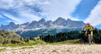
Foto itinerario MTB Da Bolzano alle Dolomiti - Italy - Trentino-Alto Adige/Südtirol, BZ

The route starts at the parking lot of the Colle di Bolzano cable car (arrive early to find a spot) and climbs up to Colle on paved road. From there, continue climbing on a forest road until you reach Nova Ponente. Following narrow roads and forest trails, you’ll reach the beautiful Pietralba Sanctuary. Then there are long ups and downs through the woods, passing by many mountain huts offering refreshments, until you reach the Lavazè Pass with stunning views of the Dolomites.
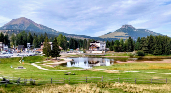
Foto itinerario MTB Da Bolzano alle Dolomiti - Italy - Trentino-Alto Adige/Südtirol, BZ

Descend a stretch on paved road and then follow a wide trail to Obereggen, where a long, scenic, flat forest road leads to Lake Carezza.
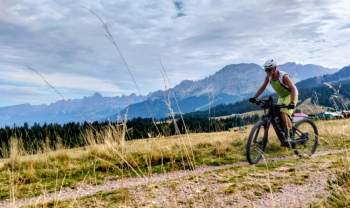
Foto itinerario MTB Da Bolzano alle Dolomiti - Italy - Trentino-Alto Adige/Südtirol, BZ

You descend to Nova Levante, climb slightly again to San Valentino di Sopra, and then take a very long descent—almost entirely on paved road—to Cardano, from where you return to Bolzano via a bike path.
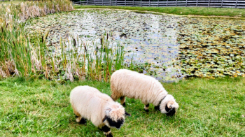
Foto itinerario MTB Da Bolzano alle Dolomiti - Italy - Trentino-Alto Adige/Südtirol, BZ

Download our free mobile app to send this route to your Garmin device or to navigate it on OSM maps. Android - iOS
Local weather
Tue 00:00
14 °C
Tue 12:00
15 °C
Wed 00:00
15 °C
Wed 12:00
15 °C
Thu 00:00
14 °C
Thu 12:00
15 °C
Fri 00:00
8 °C
Fri 12:00
11 °C
Sat 00:00
10 °C
Sat 12:00
10 °C

Graph

Nearest Routes

2023/03/05
- Italy - Trentino-Alto Adige/Südtirol, BZ
nonnocarb
(324)
41,94 km
Km
+2 000 mt
Vertical meters
Route difficulty
Landscapes
2023/03/04
- Italy - Trentino-Alto Adige/Südtirol, BZ
nonnocarb
(324)
44,92 km
Km
+1 040 mt
Vertical meters
Route difficulty
Landscapes
2023/03/04
- Italy - Trentino-Alto Adige/Südtirol, BZ
nonnocarb
(324)
71,98 km
Km
+2 000 mt
Vertical meters
Route difficulty
Landscapes
2023/02/26
- Italy - Trentino-Alto Adige/Südtirol, BZ
nonnocarb
(324)
51,38 km
Km
+810 mt
Vertical meters
Route difficulty
Landscapes
2022/10/10
- Italy - Trentino-Alto Adige/Südtirol, BZ
Robibz
(25)
46,71 km
Km
+1 235 mt
Vertical meters
Route difficulty
Landscapes
2024/04/20
- Italy - Trentino-Alto Adige/Südtirol, BZ
Robibz
(25)
39,17 km
Km
+1 090 mt
Vertical meters
Route difficulty
Landscapes
2023/05/27
- Italy - Trentino-Alto Adige/Südtirol, BZ
Robibz
(25)
18,06 km
Km
+972 mt
Vertical meters
Route difficulty
Landscapes
2023/05/08
- Italy - Trentino-Alto Adige/Südtirol, BZ
Robibz
(25)
35,17 km
Km
+1 205 mt
Vertical meters
Route difficulty
Landscapes
2023/03/01
- Italy - Trentino-Alto Adige/Südtirol, BZ
nonnocarb
(324)
48,48 km
Km
+1 910 mt
Vertical meters
Route difficulty
Landscapes
2023/03/05
- Italy - Trentino-Alto Adige/Südtirol, BZ
nonnocarb
(324)
34,16 km
Km
+1 000 mt
Vertical meters
Route difficulty
Landscapes

0 Comments