HOME RANKINGS CHALLENGES ROUTES NEAR ME PLANNING SEARCH LOGIN
Switzerland
2026/08/25 08:58:05

Täsch - Zermatt - Gornergrat

1 Downloads
0
 
Share

Key Takeaways / Scheda Tecnica

Disciplina:
Mountain Bike (MTB)
Percorso:
Täsch - Zermatt - Gornergrat
Località:
Switzerland
Distanza:
40,53 km
Dislivello Positivo:
+1 800 mt (Quota Min: 1486m - Max: 3183m)
Difficoltà Tecnica:
4/5
Valutazione Panorami:
5/5
Formato Traccia:
GPX Download disponibile
Author
Place
Switzerland
Km
40,53 km
Elapsed time
06:43:43
Vertical meters
+1 800 mt (1486 - 3183)
Route difficulty
Landscapes
Last update
2026/08/25 09:05:02
Comments
0
Description

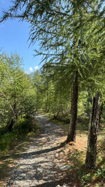
Starting from Täsch (parking: 10 CHF), we continued along the truly picturesque trail (S0 – Uferweg), which is suitable for everyone—including children—and well-marked, running alongside the Vispa River. We decided to take the trail on the right, which also runs alongside the river but offers some ups and downs (S2, Trail 150).
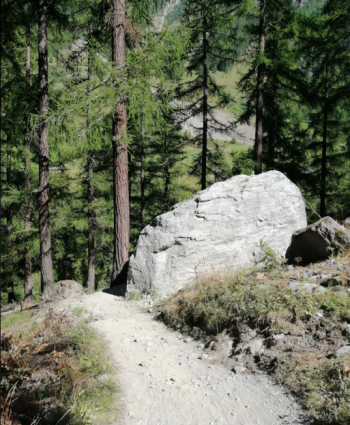
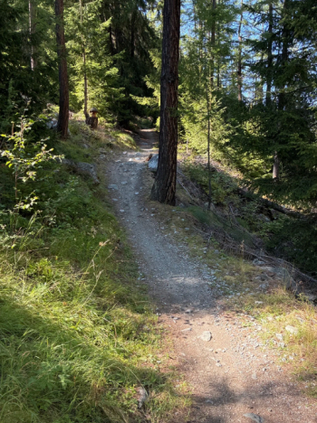
Foto itinerario MTB Täsch - Zermatt - Gornergrat - Switzerland

Foto itinerario MTB Täsch - Zermatt - Gornergrat - Switzerland

Foto itinerario MTB Täsch - Zermatt - Gornergrat - Switzerland

It’s really well-maintained. It then becomes an S1 trail all the way to Zermatt, running alongside the railroad tracks. Once we arrived in Zermatt, we took a short elevator ride (which we could easily have skipped)—it was completely free—and continued along Schluhmattstrasse. We then stopped to admire the glacier gorge from the bridge
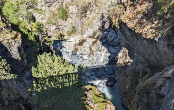
Foto itinerario MTB Täsch - Zermatt - Gornergrat - Switzerland

where the statue of the shepherd is also located
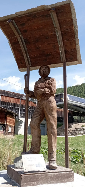
Foto itinerario MTB Täsch - Zermatt - Gornergrat - Switzerland

From there, we climbed up Moos Strasse toward the road. It’s a constant climb—turbo mode—and often we had to get off and push the e-bike At Riffelberg Station, we took the dirt trail to Gornergratt, climbing higher and higher. We’re talking about a 1,800-meter elevation gain. Personally, weighing 105 kg and standing 1.95 meters tall, my Focus—even in turbo mode at a 51-to-1 gear ratio—really struggled. Otherwise, it would either spin its wheels if I pedaled standing up and shifted my weight forward, or it would wheelie with the suspension fully compressed.
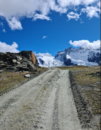
Foto itinerario MTB Täsch - Zermatt - Gornergrat - Switzerland

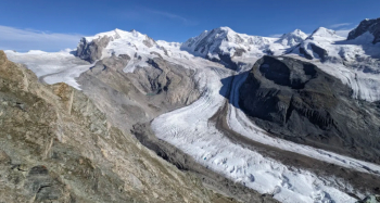
At the top of the climb, you find yourself facing this breathtaking view—it’s truly moving!
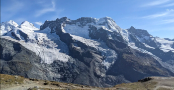
Foto itinerario MTB Täsch - Zermatt - Gornergrat - Switzerland

Foto itinerario MTB Täsch - Zermatt - Gornergrat - Switzerland

Unfortunately, global warming and pollution are causing the glaciers to retreat more and more. My actual riding time was 2 hours and 30 minutes (keep in mind that for the final stretch up to the observatory, I turned off my bike (Focus Sam2 6.9 2024 - Bosch Gen4 750Wh)—because of the cold and my desire to hit the trails, I wanted to save a little battery life).

Once we reached the top, this is the view:
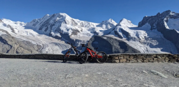
Foto itinerario MTB Täsch - Zermatt - Gornergrat - Switzerland

Cristina, on the red bike, is 1.60 tall and weighs 50 kg, and with her Decathlon E-Expl520 (70 Nm - 620 Wh), managed to reach the summit on a 16% grade, while I decided to turn off the bike completely to tackle the next trails (the path from Gornergrat to Riffelalp via Riffelsee) and the Riffelberg Trails. Next came the Untere Riffelalp Trail, and my favorite was the Schweigmatte Trail—a succession of banked turns, jumps, and even a few drops! The final trail was the Moos-Trail, which takes you all the way to Zermatt.

Truly an adventure—a tough one, not for everyone—but one we’ll definitely remember.

Download our free mobile app to send this route to your Garmin device or to navigate it on OSM maps. Android - iOS
Local weather
Mar 00:00
10 °C
Mar 12:00
15 °C
Mer 00:00
11 °C
Mer 12:00
7 °C
Gio 00:00
2 °C
Gio 12:00
6 °C
Ven 00:00
6 °C
Ven 12:00
6 °C
Sab 00:00
3 °C
Sab 12:00
3 °C

Graph

Nearest Routes

27,22 km
Km
+1 332 mt
Vertical meters
Route difficulty
Landscapes
32,17 km
Km
+1 969 mt
Vertical meters
Route difficulty
Landscapes
2022/12/22
- Italy - Valle d'Aosta, AO
gmzolenart
(137)
19,73 km
Km
+1 385 mt
Vertical meters
Route difficulty
Landscapes
2022/08/06
- Italy - Valle d'Aosta, AO
gmzolenart
(137)
16,23 km
Km
+931 mt
Vertical meters
Route difficulty
Landscapes
2025/07/18
- Italy - Valle d'Aosta, AO
grip82
(3)
23,57 km
Km
+1 600 mt
Vertical meters
Route difficulty
Landscapes
2025/11/19
- Italy - Piemonte, VB
nonnocarb
(324)
13,43 km
Km
+350 mt
Vertical meters
Route difficulty
Landscapes
2022/08/22
- Italy - Valle d'Aosta, AO
nonnocarb
(324)
22,30 km
Km
+468 mt
Vertical meters
Route difficulty
Landscapes
2022/08/22
- Italy - Valle d'Aosta, AO
nonnocarb
(324)
17,25 km
Km
+700 mt
Vertical meters
Route difficulty
Landscapes
2022/08/22
- Italy - Valle d'Aosta, AO
nonnocarb
(324)
19,82 km
Km
+989 mt
Vertical meters
Route difficulty
Landscapes
2023/09/29
- Italy - Valle d'Aosta, AO
gmzolenart
(137)
14,52 km
Km
+864 mt
Vertical meters
Route difficulty
Landscapes

0 Comments