Italiano
 Deutsch
Corno Bussola da Brusson
This route is reserved for experienced cyclists; there are three sections that aren’t particularly difficult but, since you’ll need to push your bike through them, they do require some experience. We did this trip on e-bikes. We parked in Brusson along the road to Col de Joux on the left side of a meadow; there were other cars there, and a local told us it was okay to park there. Otherwise, there’s paid parking at the small lake, or there are some parking spots along the climb to Estoul.
Take the road to Estoul and then the dirt road to the Arp refuge. At the head of the valley, within sight of the Arp refuge, there’s a fork in the road: to the right, the path climbs to the refuge; we take the left to reach the lower Alpe di Palasinaz and then the trail to the Palasinaz lakes. We reach Lago Battaglia and follow the trail on the right (3C), which leads us almost level to the end of the ride.
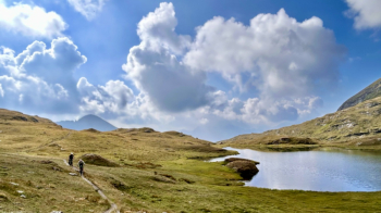
The trail climbs steeply, and from here on (approx. 500–600 meters of elevation gain), cycling will be only symbolic.
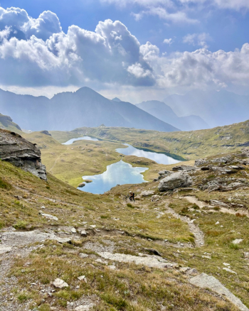
You’ll reach the saddle of Colle Bussola, where the first equipped section begins. It’s short, but the bike won’t help here.
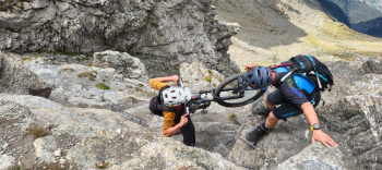
You keep pushing on, but the summit is now close. You reach the 3C-3D junction, leave your bike behind, and climb the final few meters to the summit cross at 3,022 meters. A 360° panorama of all the peaks of the Aosta Valley (unfortunately not today).
The descent begins. Take Trail 3D, which, after a short traverse and a brief climb, catapults you to the edge of the ridge: stay fully focused so you don’t end up in one of the thousands of lakes visible below!
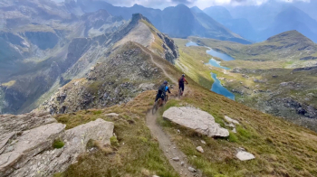
The ridge is all S3, but with a couple of sections only manageable by the most skilled climbers; otherwise, it’s a real treat. The trail leads to the Palasinaz Pass, where there are also a couple of equipped but easy sections.
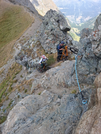
From the pass, you could take a shortcut to descend directly back to the lakes; instead, the trail continues along the ridge, first climbing, then skirting Punta Palasinaz with a few sporadic ups and downs as it heads toward the Valfredda lakes. At one point, without reaching the next pass, we headed straight down the steepest slope.
An easier trail then leads to the ARP mountain hut. From the hut, follow a nice traverse that brings you back to Alpe Palasinaz, then climb a few meters to take a pleasant trail that avoids the road. Before reaching the road, without crossing the stream, take a barely visible trail across the meadow that leads to Mèrendioux (S2). You’ll emerge onto a dirt road, which you follow for a short stretch to Lavassey (fountain) to rejoin the (beautiful) trail leading to Pacard (S2).
We come out onto another dirt road, and since we haven’t had enough of it, we climb up almost to Bringuets to connect with the final trail—which is also beautiful—and then head down. At the next fork, we chose the trail on the right; if you prefer, there’s one that descends more directly, but in any case, you’ll be back on the road in no time.