Italiano
 Deutsch
Val d’Ayas: Colle Palasina

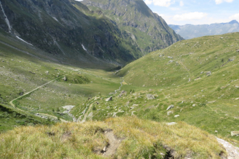
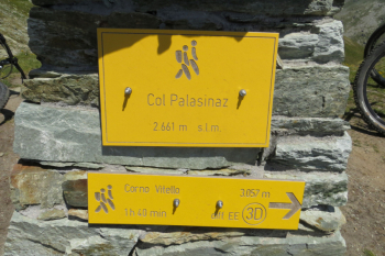
From Estoul (1,818 meters) with trail No. 5 follow the dirt road to the upper part of the facilities, following the signs for the Arp Refuge (the fountains are in Brusson, before Estoul, at the beginning of the dirt road at the junction between pedestrian and mule track sent.). When you reach the plateau after skirting the slopes of Bieteron, take a left for the lakes of Palasinaz and Corno Bussola, then leaving the hut on the right. This is followed by a climb to the end of the dirt road and after 50 meters of shoulder biking you reach the upper plateaus and the various Palasina Lakes. Continue on the well-marked trail that heads to the Palasina Pass 2,661 meters, which can be reached in 20 minutes with the bike on the side. Magnificent views, on the north side Matterhorn, Rollin's Hump , Little Matterhorn, Breithorn, Pollux, Castor and, in the mists, Lyskamm; on the south side Lake Coliou and Battaglia, at the bottom of the ascent path the plateau of Lake Literan.
Descent on trail #14: first section, evident in photos, cyclable; follows a rocky section with bike alongside, then all flow arriving at Chavannes and Mascognaz. Then nice technical trail with small stones and roots to Champoluc, from here first section of trail to orographic left of Evancon stream, follows section to orographic right near Periasc. The section from Extreperiaz to Brusson in summer is very busy, watch out for pedestrians. Monk track, round trip done by leaving cars at Brusson and Estoul, so 500 meters of elevation gain on asphalt is saved.
Hiker's Editor No. 8 Trail map 1:25000 High valleys of Ayas and Lys Monte Rosa
Uphill, view of Tersiva
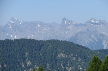
View of Matterhorn, Rollin's Hump, Little Matterhorn, Breithorn, Pollux, Castor and , in the mists, Lyskamm
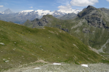
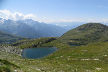
South side Lake Coliou and Battaglia, at the bottom of the ascent path the plateau of Lake Literan
Descent trail No. 14, first flow section

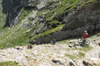
Pushing section
Section towards Chavannes