HOME RANKINGS CHALLENGES ROUTES NEAR ME PLANNING SEARCH LOGIN
Italy - Lazio, RI
2026/08/05 14:55:17

Terminillo: Pian de rosce - 5confini - Campoforonga - Terminilluccio - Bosco Cardito

1 Downloads
0
 
Share

Key Takeaways / Scheda Tecnica

Disciplina:
Mountain Bike (MTB)
Percorso:
Terminillo: Pian de rosce - 5confini - Campoforonga - Terminilluccio - Bosco Cardito
Località:
Italy - Lazio, RI
Distanza:
29,97 km
Dislivello Positivo:
+1 093 mt (Quota Min: 1110m - Max: 1848m)
Difficoltà Tecnica:
2/5
Valutazione Panorami:
5/5
Formato Traccia:
GPX Download disponibile
Author
Place
Italy - Lazio, RI
Km
29,97 km
Elapsed time
04:22:55
Vertical meters
+1 093 mt (1110 - 1848)
Route difficulty
Landscapes
Last update
2026/08/05 18:55:49
Comments
0
Description

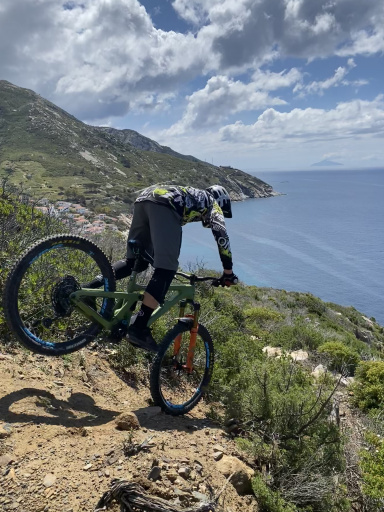
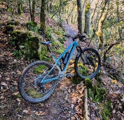
A wonderful mountain bike route, particularly recommended during the summer for cycling in the cool air and escaping the high temperatures of the Roman plain. The entire route is rideable on a mountain bike (i.e., without a motor). You can refill your water at km 10.4, at the Campoforonga bar, and at Pian de’ Valli. The trail consists mainly of gravel on the uphills and dirt on the downhills, offering a pleasant mix of smooth riding and fun.

The route starts at Pian de Rosce, at an elevation of about 1,100 m. You’ll begin by riding about 2 km uphill on paved road along Via Terminillese, then turn onto the off-road trail at the third hairpin turn. From here, a long climb of about 12 km on gravel begins, leading to a short paved section near the Cinque Confini Sports Field, located at an elevation of about 1,580 m.

The route then continues toward Campoforogna, where you can take a break at the bar, before tackling the final climb to the summit of Terminilluccio, at an elevation of 1,840 meters.

From the summit, a technical and challenging descent begins toward the village of Pian de’ Valli. The route then veers toward Monte Cardito, where a long and spectacular descent through the woods begins, following trails and cart tracks that are mostly unpaved. The route is generally smooth, except for a couple of short, steeper sections that require extra caution.

The route ends near the parking lot, where you rejoin the Via Terminillese, completing a loop that offers great scenic and athletic rewards.

Download our free mobile app to send this route to your Garmin device or to navigate it on OSM maps. Android - iOS
Local weather
Tue 00:00
11 °C
Tue 12:00
16 °C
Wed 00:00
14 °C
Wed 12:00
12 °C
Thu 00:00
9 °C
Thu 12:00
11 °C
Fri 00:00
7 °C
Fri 12:00
12 °C
Sat 00:00
6 °C
Sat 12:00
10 °C

Graph

Nearest Routes

2024/01/31
- Italy - Lazio, RI
34,37 km
Km
+1 948 mt
Vertical meters
Route difficulty
Landscapes
2025/01/31
- Italy - Lazio, RI
federfana
(2)
24,16 km
Km
+1 074 mt
Vertical meters
Route difficulty
Landscapes
2024/02/29
- Italy - Abruzzo, AQ
39,84 km
Km
+1 610 mt
Vertical meters
Route difficulty
Landscapes
2026/03/09
- Italy - Lazio, RI
30,37 km
Km
+1 194 mt
Vertical meters
Route difficulty
Landscapes
2024/07/12
- Italy - Abruzzo, TE
35,13 km
Km
+1 650 mt
Vertical meters
Route difficulty
Landscapes
2023/06/26
- Italy - Umbria, PG
37,07 km
Km
+1 000 mt
Vertical meters
Route difficulty
Landscapes
2024/01/31
- Italy - Lazio, RI
25,87 km
Km
+1 656 mt
Vertical meters
Route difficulty
Landscapes
2024/07/03
- Italy - Marche, MC
Strauss
(14)
58,18 km
Km
+2 653 mt
Vertical meters
Route difficulty
Landscapes
2024/04/15
- Italy - Umbria, PG
nirusteso
(3)
40,13 km
Km
+425 mt
Vertical meters
Route difficulty
Landscapes
44,85 km
Km
+1 600 mt
Vertical meters
Route difficulty
Landscapes

0 Comments