Italiano
 Deutsch
Civetta Superbike Enduro 2
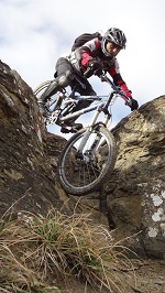
Civetta Superbike, new compilation: an enduro loop combining flow, technical sections, and nearly 3,000 meters of descent. A new version of the Civetta Superbike, an updated route using the tracks available for download from the website of the same name and optimized with some new descents compared to the previous route. The route can be tackled either by using the ski lifts or by e-bike; for this outing, we opted for the latter. The ride starts from Piani di Pezzè, following the forest road toward Forcella Alleghe. The climb features generally steady and moderate gradients, though interspersed with a few decidedly challenging sections.
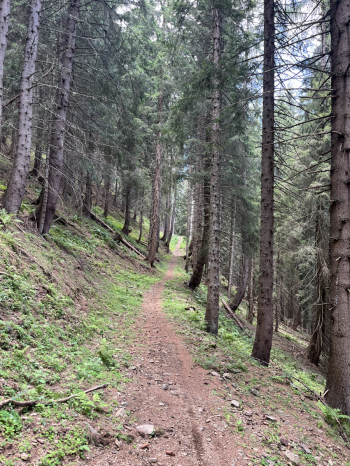
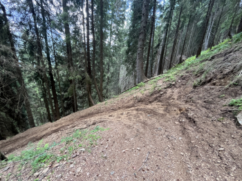
Once you reach the pass, the trail descends toward Malga Pioda until a hairpin turn where the first trail of the day begins: the Wilde Trail, whose very name evokes the wild. The start features very steep sections, followed by a fun singletrack full of curves, technical sections, and natural passages. Compared to last year, the trail has been significantly improved, and work is still underway to make it even smoother. The final section offers excellent flow through the woods. The predominant difficulty level is S2, with some S3 sections. At the end of the descent, you reach a forest road leading to Pecol Vecchio. From here, a new climb begins; at the fork, it’s best to keep left—though this means tackling the steeper section—all the way to the Pian de Crep Mountain Hut. This is where the second descent begins: the Lendina Trail. The first section is a fun toboggan run through the woods, followed by a guided section with more technical passages, steep slopes, and challenging stretches (S2).
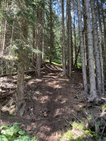
Once on the forest road just above Baita Civetta, I chose to head back up toward Pian de Crep, since the Lendina Trail continues downvalley on a dirt road. Back at Pian de Crep, here’s the second new trail of the day: the Foppe Trail. You descend for a short stretch on the ski slope, then keep left and left again. After a brief initial traverse, the trail really gets going with a series of steep sections and hairpin turns featuring parabolic curves, wall rides, natural jumps, flow sections, and more steep sections. A decidedly dynamic and fun descent. Once you reach the valley, head back up along the forest road, but at the fork, it’s best to keep right, choosing the gentler route back to Pian de Crep.
The ride continues with a new descent: the Cristelin Trail. After a short stretch on a narrow road, you enter an excellent singletrack that alternates between steep sections, well-connected switchbacks with berms, jumps, and steps. It’s a real blast all the way to the last turn, rated S2. From Pecol, you climb on asphalt toward Palafavera and then, following the forest road with a steady gradient, you reach Malga Vescovà. You then turn right toward Malga Fontana Fredda until reaching Forcella Pocol. You continue along the forest road, with a few tough climbs, cragging just above the Fertazza Mountain Hut and descending to the hut. From here begins another of the most interesting trails on the entire loop: the ScoobyDoo Trail, which we tackled right from the start—a choice that proved to be absolutely spot-on.
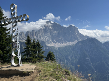
The trail starts just below the chairlift and offers a continuous sequence of steep sections, well-connected switchbacks, wall rides, steps, technical sections, and compressions, keeping you on your toes the whole time. Once you reach a forest road, you tackle the final climb toward the Fertazza Mountain Hut, with generally moderate gradients, and then continue toward the Belvedere Mountain Hut. On this occasion, I chose to follow the trail that climbs to the right: it’s steep but easily rideable on grassy terrain and allows you to avoid the steepest sections encountered when taking the left route before reaching Cima Belvedere. This is where the grand finale begins: over 1,000 meters of descent along a route I’d never taken before, which turned out to be one of the most beautiful descents in the entire Civetta area. After an initial stretch through the mountain pastures, a steep slope leads into the most spectacular section near Col Davagnin, keeping to the right. The singletrack alternates between flowing sections, technical passages over rocks, loose stones, natural steps, and perfectly connected turns, without ever losing momentum.
At a fork, I chose the left-hand variant (with beautiful technical sections), which later rejoins the main trail. The result is a long, varied, and rewarding descent that ends directly on the Caprile state highway, making use of practically every available meter of elevation drop. From here, all that’s left is to follow the easy bike path back to Alleghe, with the satisfaction of having completed one of the most interesting, well-rounded, and fun enduro rides in the entire Civetta area.