Italiano
 Deutsch
Alta via dell'Orso - Colle S.Lucia

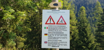
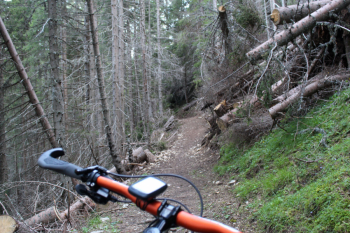
Hiking trail designed and proposed by the municipality of Colle S.Lucia, at the entrance to Val Fiorentina. It is inspired by the novel "The Bear's Skin" by Padua writer Matteo Righetto, set in the Dolomites. The original hike would be 9 km with 400 meters elevation gain to be covered in 3 hours. The modified route is 500 meters of elevation gain, which by mtb is done in 1½ hours, almost entirely on dirt road. You climb from the road to the right of the Fursil pizzeria to the upper hamlets, at Sopradaz the asphalt ends and you continue on a path that is steep in places. You pass cason dai coi 1,667 m, water point, and finally forzela 1,808 m., the highest point.
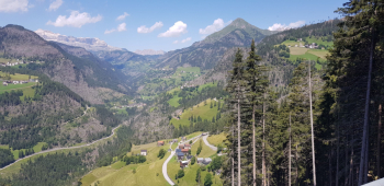
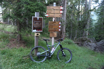
Start the flowing descent into the forest, pass the junction to Colcuc, continue and cross Rio Pignazza to climb briefly and arrive at Col di Larzonei. You take the vein road again and arrive at Colcuc. Because of works for a stretch you have to continue on asphalt and rejoin the path near the hamlet of Tie and then climb up to hamlet Canazei. Shortly after the Canazei sign you see a fence on the right and a faint sign of a path on the crest of the hill to take to descend again on dirt road to the square of Colle Santa Lucia. Beautiful initial view of Pelmo and Civetta, then from Colcuc over the entire upper Cordevole Valley, Larzonei, Laste, Pieve di Livinallongo, Col di Lana, Piz Boè, M.Pore.
Tabacco editore n.07 - Alta Badia - Arabba - Marmolada - Trail map (1:25,000)
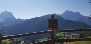
Pelmo, Colle S.Lucia, Civetta
Laste, Pieve di Livinallongo, Larzonei, Piz Boè, Col di Lana