Italiano
 Deutsch
Monte Capio, Miniere di Nichelio
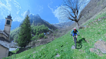
A beautiful hike through Valsesia, with Monte Rosa in the background, to reach the ridge of Monte Capio (2,172 meters). Start from a convenient parking lot for RVs in Varallo Sesia. Upon exiting the parking lot, turn left onto Via Morgiazzi, cross an old Roman bridge, and once you reach the paved road, backtrack a short distance until you reach a mule trail that climbs steeply and leads to the small church of San Pantaleone. Follow the trail through the woods to reach the hamlet of Le Folle. Cross the Mastallone stream and return to the paved road, passing through Cravagliana, Nosuggio, and Saliceto; at Voj, turn right to climb to Rimella. Upon reaching Villa Superiore, take a forest road that serves the beautiful mountain pastures in the valley; with an easy ride, you’ll reach the top of Alpe Wan.
From here, alternating between pedaling and pushing, continue climbing toward Bocchetta di Campello; at the fork where you see a small white chapel, turn right toward Alpe Pianello. After passing the Baita Sociale Cai Borgomanero, you’ll reach Alpe Sinanecca. From here, a traverse that climbs gently at first and then with very steep gradients leads to Bonda Piatta (1,930 meters).
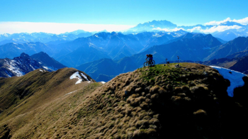
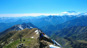
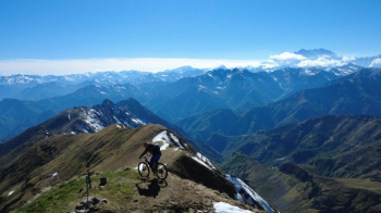
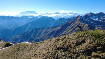
On the weekend of May 1st, there were still three snowfields extending down a few hundred meters from the top, so you need to be especially careful (FBL). From Bonda Piatta, you descend toward Alpe dei Laghetti and from there begin climbing again toward the old Nichelio mine. Zigzagging, sometimes pushing, sometimes carrying the skis on your shoulders, you ascend through a truly evocative ochre-colored landscape. You catch a glimpse of the beautiful ridge of Monte Capio and reach a small pass that leads to the summit in 10 minutes.
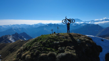
After ringing the bell, begin the descent along the entire ridge back to Bonda Piatta. From here, descend again to Alpe dei Laghetti and then down to Alpe Campo. Take a mule track that leads down to Montata. Upon reaching the crossroads with the Sabbia stream, you climb back up along the trail to just below Alpe Pradeloro and, via a mule track, emerge at Sabbia. Return to Varallo via the paved road.