Italiano
 Deutsch
Grande Traversata Elbana MTB All Mountain

The Grande Traversata Elbana MTB AM route is based on the GTE Nord trekking route, limiting deviations to those sections that are impassable by bike (whether uphill or downhill), prioritizing rideability (at least 90%) while minimizing paved sections and striving to preserve the scenic character of the original route. This version therefore differs from other GTE MTB routes found online. Compared to the original GTE trekking route, the variations are as follows:
1) The descent from Monte Grosso (impossible to bike) and the corresponding ascent; alternatively, follow the dirt road that climbs through the Realbano mine.
2) The extremely difficult climb up Monte Strega, which is impossible by bike; the alternative is to bypass the mountain from the east along a slightly uphill traverse and rejoin the GTE at Passo della Croce, then continue on the GTE to Case Marchetti.
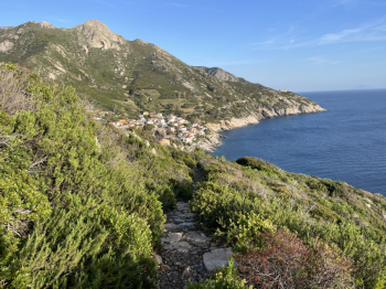
3) The tough climb to Monte Otello (less than 60% rideable); the lower route to the north is preferred, which rejoins the Schiumoli spring and continues on the GTE to San Martino.
4) The steep descent toward Case Milani (impossible to bike); the Guendalone descent is preferred, which is challenging but 100% bikeable.
5) The steep climb to Monte Castello; follow the forest road to San Ilario and rejoin the GTE at Colle Reciso.
6) Avoid the direct climb to Monte Perone; follow the forest road (steep but 100% rideable) which still leads to Monte Perone.
7) Then leave the GTE again, which follows the ridge trail to Feliciaie; instead, take the lower trail that connects to the GTE at the intersection with the trail ascending from Poggio.
8) Final variation from the GTE: instead of proceeding to Tavola and then descending to Partesi via Raggioverde (very challenging by bike), continue toward Madonna del Monte, Serra Ventosa, and Toppolo; for the final descent, head down to Chiessi, which is still a beautiful yet challenging trail, especially at the end of the day.
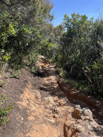
Start from Cavo toward Rio Marina, and after a short stretch on asphalt, turn right to climb up the easy dirt road of the Realbano mine (the site is currently undergoing a nice redevelopment). Once over the hill, there’s a short descent followed by a nice trail that climbs gradually (just a couple of steep sections at the end). A short stretch of asphalt leads to a forest road on the left that climbs steeply and joins the GTE. Continue along the GTE; the uphill trail is easily rideable (though there are a few sections where you’ll need to push) and leads to the slopes of Monte Strega. Turn left and after 100 meters of asphalt, take a scenic, gently ascending traverse that runs along the slopes of Monte Strega (excellent rideability, with only one challenging steep section) until you reach the slopes of Monte Capannello.
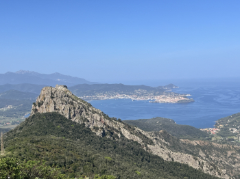
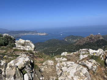
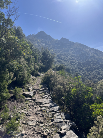
Follow the GTE as it climbs to Monte Capannello; it’s almost entirely rideable except for a couple of sections (50 meters total), and then you’ll reach the summit. (Alternatively, a forest road on the left goes around the mountain.) Once you reach Panche, the tough climb to Cima del Monte begins (following the GTE). There are challenging sections, and in a couple of spots (about 100 meters), you’ll need to push due to the steep slope and uneven terrain. From Cima del Monte, the view is spectacular. A beautiful technical descent over rock begins, challenging in places (S4-S5), and you arrive on the forest road at the slopes of Monte Castello. Follow the forest road (GTE), which then turns to asphalt, and descend quickly to Case Marchetti. A short stretch of asphalt runs alongside the golf courses, then onto a dirt road that climbs gradually toward Colle Reciso.
At Fontana Schiumoli, rejoin the GTE. Follow the GTE along the beautiful forest road that climbs gradually and then descends to San Martino. Here, turn right and then left to take the Guendalone. A technical descent that alternates between flowing sections and challenging sections on rock and dirt, with loose stones in places. Near Colle di Procchio, keep left and descend a short stretch on asphalt before taking the dirt road that climbs toward S. Ilario. A few steep sections, then the beautiful forest road with a moderate gradient leading to S. Ilario. Before reaching it, take the tough climb to the right that leads to Monte Perone. Asphalt followed by a dirt road with steep but rideable sections. Once over the Monte Perone pass, a short descent on asphalt leads toward Poggio, then take the trail to the left that runs along the Nivera Valley and brings you back to the GTE.
The climb is mostly rideable with a moderate gradient, though there are a few rocky sections where you’ll need to push. Once you reach the junction with the trail leading up to Monte Capanne, the sections requiring pushing are practically over. A nice traverse over large rock slabs (GTE) and, after passing the cable car, the traverse begins to descend. Then take a nice technical downhill section to the right that leads to the forest road toward Marciana. At a junction, keep left to climb back up toward Madonna del Monte. From here, the traverse to Serraventosa and then the (technical) descent toward Bollero and the (technical) climb to Troppolo. Here, keep to the right to descend toward the traffic light and turn left onto the final descent to Chiessi. A challenging descent (S5) in the upper section, characterized by rock steps and technical sections; the lower part is more flowing over loose stone, but technical sections and hairpin turns are still present here as well. Arrival in Chiessi via a final stretch of mule track.