Italiano
 Deutsch
Buca del Brigante

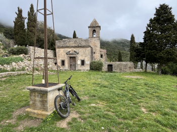
Start from Bagnaia and return for a short stretch of asphalt towards Portoferraio and then left up towards Volterraio to Passo Le Panche. Here on the left you take the Mezza Strega trail that descends to Monte Capannello. Short descent and you arrive at a plateau where the first trail called Le Scalette (cai 53) begins here. It is a technical and scenic descent that alternates short flowing sections (initial) with technical passages, steps and on rock, switchbacks and again more flowing sections (nice tough final section). You reach the road leading to Nisposto and continue to Strega Pass. Here a variant to visit the Convent of Santa Caterina; short climb to the left (cai 102) and then to the right a short but steep descent to the little church.
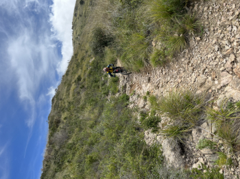
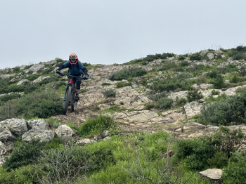
Take the trail again and after a couple of short but intense climbs complete the trail on the road leading to Rio nell'#elba (right). Short stop in Rio Nell'Elba and then hard climb first on asphalt and then dirt road until you reach the top of the hill at Le Panche.Here we take the GT and ridge trail (left) that immediately climbs very hard, but near Cima del Monte it becomes decidedly steeper, with stretches even if short, pushing even with e-bikes, due to the very uneven surface.From the vantage point at the top of the mountain, the splendid Buca del Brigante trail begins: first slightly exposed and technical section, then the trail alternates flow sections with technical passages, switchbacks, steps, jumps, compressions and climbs and again flow sections. The trail arrives on the SP near Bagnaria, here you turn right and shortly return to the parking lot.