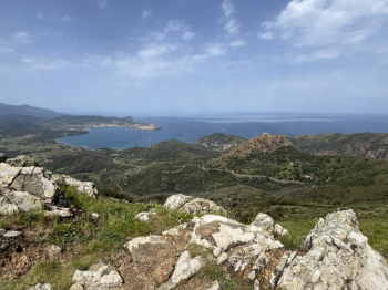
Da Rio nell'Elba a Portoferraio
From Rio nell'Elba to Portoferraio with a compliation of nice descents. Start at Le Panche and climb to Monte Capannello and then go down the trail (singletrack on loose rock and then flow) Half Strega to Strega Pass and here take the Vignola trail.It starts out quiet and flowing with dirt surface (moderate gradient) and then changes to surface with outcropping rocks (firm) and a few technical passages and a nice peppery final descent bordering on trialistic on rock.Take a right on asphalt towards Rio nell'Elba and at La Parata turn left for Dragut: a nice climb on rock and pedalable boulders in good part to get to the Dragut attack. A nice flowing trail with jumps and wallrides on dirt, then change to more technical sections with steps, compressions and steep slopes.
When you get to the asphalt left and climb along the coast to take the GTE trail (a comfortable medium gradient forestry) that climbs towards the Termine mine. Just before Termine take a trail to the left (Calcinaia). The first section is a slight climb on well pedaled singletrack with a few rips to then get to a short descent on rocky terrain and a new climb on forestry to get to the SP that leads to Rio nell'ELba and from there to the Panche.Here left for the very hard climb on dirt road to Cima del Monte (very hard even on an ebike) and arrived at the top begins the splendid descent of Buca del Bandito, very varied: flow stretches, technical sections and trialistic passages on rock and again jumps, steep slopes...a real blast.
Arrived on asphalt to the left and then after Magazzini you take minor roads and dirt tracks to get to the GTE in Val di Piano and follow it (quiet cart track) to Colle Reciso and here on the right you follow the trail to S.Lucia. Dirt track and hard climb on rocks and steps (about 200m push) to the little church.Here the last trail: the trail is not the best: narrow and hollowed out by water, very technical and with wet ground it is definitely challenging. Moderate slope but rocks and steps and the channel do not allow many trail alternatives. It is arrived on the SP just before Portoferraio and by asphalt in beve to reach the port.


 Italiano
 Deutsch