
 Italiano
 Deutsch
Val Vedra Ortighera

Here is the description for this loop between Val Vedra and Ortighera. A ride full of contrasts: breathtaking views, brutal climbs, and a final descent that, as you noted, is more of a survival exercise on the gravel than pure enjoyment.
Val Vedra and the "Ghiaione" of Ortighera
To call this route “ambivalent” is an understatement. While the first part will bring smiles and unexpected flow, the second will put you to the test with endless portage and a final descent you’ll probably never want to repeat. I’ve warned you: do it for the views (a 10 out of 10), but be prepared for some serious cycling hardship.
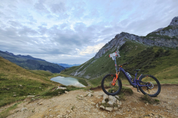
Ascent 1: Toward Branchino
The start is in Bordogna (Roncobello). You hit challenging trails right away (an e-MTB is highly recommended) before switching to paved roads with manageable gradients up to the Baite di Mezzeno, a great spot to refill your water. From here, deflate your tires: a tough stretch begins that will take you above Lake Branchino. On an e-MTB, you’ll likely pedal about 50% of the way; the rest is pushing, but the view begins to reward the effort.
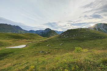
Descent 1: The jewel of Val Vedra
Once you reach Passo del Branchino, stay high as you follow the valley to the start of the real descent. This is where the fun begins: a perfect mix of flow, rocky sections, and a few technical passages that are never too challenging. The finale is a thrilling flow section that will put a smile on your face. WARNING: Don’t be tempted by the bottom of Val Vedra; stay on the trail or you’ll face two hours of walking with your bike in hand.
Ascent 2: The Aliens’ Meadow
Use the adrenaline from Val Vedra to tackle the climb. The ascent is manageable up to 1,200m, but the final 200 meters of elevation gain feature killer steep sections: stuff for “aliens” or bikes with plenty of power. From there on, it’s push mode for 600 meters of elevation gain across endless meadows. Those with an e-MTB can attempt a laborious zig-zag to stay in the saddle; for everyone else, it’s pure portage.
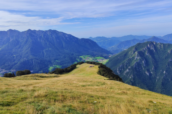
The Final Descent: The Enigma of Ortighera
After veering west on poorly defined trails and a “eat and drink” section that isn’t exactly smooth, you reachOrtighera. If you’re expecting a grand finale, think again. The descent didn’t thrill me: the real technical challenge here isn’t the S4 section, but managing to stay in the saddle on unstable scree that will accompany you all the way down to the valley. A finale that serves more to close the loop than to satisfy the craving for technical riding.
Trail style: AM
Personal rating: Views 9/10; Descents: 1st descent 7/10, 2nd descent 5/10
Riding difficulty: High
MTB: Yes
EMTB: Yes, if you don’t mind using walk mode
Duration: About 8 hours on an e-MTB
Portage: Yes, about 200m of pushing to Branchino and 600m across meadows toward Menna
Rideable ascent difficulty: Riding is smooth up to the Mezzano huts; the climb after Zorzone is very challenging (I’d say EMTB only)
Descent difficulty: Val Vedra S2 (moderate) with some S3 sections; Ortighera S2
Exposure: Nothing in particular
Exhausting: Yes
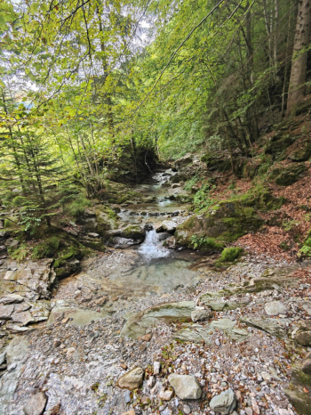
Water sources: Roncobello, Mezzeno huts, Zorzone


