HOME RANKINGS CHALLENGES ROUTES NEAR ME PLANNING SEARCH LOGIN
Italy - Veneto, BL
2025/08/12 18:50:35

Il giro dei 5 rifugi del Fanes

2 Downloads
0
 
Share
Author
Paoloc1
(85)
Place
Italy - Veneto, BL
Km
46,01 km
Elapsed time
05:34:04
Vertical meters
+2 700 mt (1368 - 2356)
Route difficulty
Landscapes
Last update
2025/08/12 21:07:39
Comments
0
Description

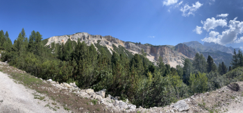
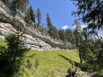
Spectacular dolomite tour (although now a classic). Start from the cantoniera house just before Cimabanche and climb Cai 8 following the forest road (some nice steep sections) all rideable. At Forcella Lerose take Cai 8 that follows the old military road and descends to Rifugio Rastua (flow without technical difficulties). From Rastua follow the dirt road and go up to the Biella refuge (Cai 6 ); some very steep climbs and gravel bottom, but still 100% rideable. From Rif Biella the spectacle is unique.You descend a little (for the dirt road made on the way up) and intercept the Cai 6a trail that leads to the Sennes hut. First uphill section pushing through small rocks, then the plateau is beautiful: an all-pedalable single track with a few ups and downs until the final short, but challenging steep, and shortly you reach the Sennes.

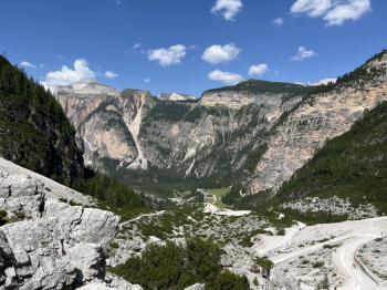
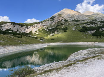
Follow the forest road to Rifugio Fodara Vedla but before you get there take a path to the right that leads to Rifugio Pederù. Scenic and technically fun trail, but in fact short because it only cuts the high hairpin bends of the forest road that climbs from Pederù. From Pederù hard climb to Fanes hut: dirt road with some long steep sections. From the Fanes the last few hairpin bends to climb down to the Forcella del Limo and pass by the lake of the same name. Then from here a long, fast descent on the forest road to the Cascate di Fanes waterfalls and shortly after to the left to return to the state road at the StUberto parking lot. Here follow the quiet forest road to Cimabanche and shortly arrive at the parking lot.


Download our free mobile app to send this route to your Garmin device or to navigate it on OSM maps. Android - iOS
Local weather
°C
°C
°C
°C
°C
°C
°C
°C
°C
°C

Graph

Nearest Routes

2022/10/24
- Italy
nonnocarb
(294)
34,78 km
Km
+1 493 mt
Vertical meters
Route difficulty
Landscapes
2023/02/26
- Italy - Trentino-Alto Adige/Südtirol, BZ
nonnocarb
(294)
30,49 km
Km
+1 550 mt
Vertical meters
Route difficulty
Landscapes
2022/08/05
- Italy - Veneto, BL
gmzolenart
(116)
40,45 km
Km
+1 717 mt
Vertical meters
Route difficulty
Landscapes
2022/09/23
- Italy - Trentino-Alto Adige/Südtirol, BZ
38,19 km
Km
+2 350 mt
Vertical meters
Route difficulty
Landscapes
2023/02/26
- Italy - Trentino-Alto Adige/Südtirol, BZ
nonnocarb
(294)
18,05 km
Km
+833 mt
Vertical meters
Route difficulty
Landscapes
2022/10/22
- Italy - Trentino-Alto Adige/Südtirol, BZ
nonnocarb
(294)
31,76 km
Km
+1 223 mt
Vertical meters
Route difficulty
Landscapes
2024/10/04
- Italy - Trentino-Alto Adige/Südtirol, BZ
Staff
(98)
22,54 km
Km
+950 mt
Vertical meters
Route difficulty
Landscapes
2023/07/17
- Italy - Veneto, BL
ste97
(4)
88,97 km
Km
+4 609 mt
Vertical meters
Route difficulty
Landscapes
2022/10/02
- Italy - Veneto
30,52 km
Km
+1 327 mt
Vertical meters
Route difficulty
Landscapes
2024/01/16
- Italy - Veneto, BL
@ff.mtb
(9)
48,76 km
Km
+1 500 mt
Vertical meters
Route difficulty
Landscapes

0 Comments