
 Italiano
 Deutsch
Rifugio Mezzalama, Lago Blu e Alpe Varda Trail

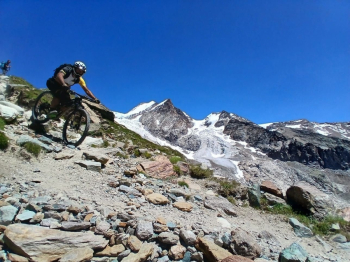
Cyclo-mountaineering tour with long climbs by bike (700 meters on the total elevation gain of 1600) and challenging descents with exposed sections and sometimes inconsistent terrain. We start in Frachey at an elevation of 1640 meters and first ride on asphalt to the last village in Val d'Ayas, Saint Jacques des Allemands. From here we follow the shady, human-graded farm track to the lower Pian di Verra, where we get a view of Monte Rosa. From right to left we glimpse the Breithorn, Black Rock, Pollux, Castor, Lyskamm.
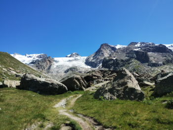
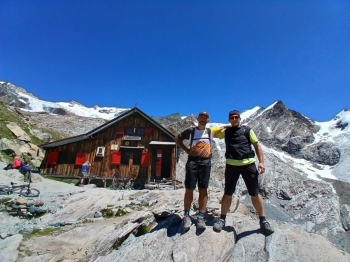
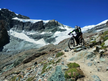
The track continues on level ground crossing the Verra plains and thrilling us with grandiose views of the highest peaks. At the bottom of the valley you start climbing again, with a few harder but still rideable sections, and you arrive at the post (2335 meters) from where trail No. 7 begins, which climbs to Rifugio Mezzalama. Here forget as well (except for a very short flat section) the bike on your back until you reach the hut at an altitude of 3036 meters. The trail first climbs a grassy slope and then moves over the crest of the glacial moraine to the summit. Almost there we can appreciate the contrast between the wooden walls of the Refuge and the white glaciers all around.
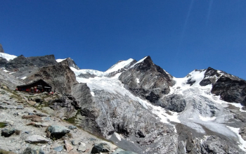
At the refuge, when open, you can find something to eat or as in our case, a good slice of cake to restore the energy expended climbing up here.
We put on our protective gear, the (non-trivial!) descent awaits us.
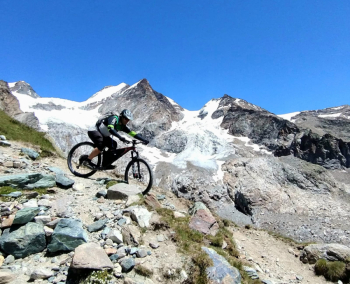
Once back at the farmstead, we make a hundred meters or so and then immediately take the path to the right that brings us back first to the crest of the moraine and then to Blue Lake.
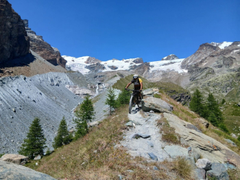
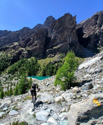
Blue Lake of incredible color and transparency! From here the descent trail to the Pian di Verra is a bit erratic but gives rewarding passages.
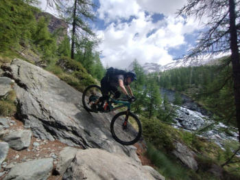
Back across the Pian di Verra the descent begins again, all on fixed rock, to Saint Jacques. This section if tackled with the right speed allows you to float above any possible obstacle, you do it all in the saddle until you reach a small wooden bridge just above the village, where we will take off our protections to face the last 250 meters of pedaled ascent to the entrance of trail 5, for Alpe Varda. For those who want to lengthen the tour, you could also go up to the Tournalin Refuge and descend back down to here from the AV1 trail. The last part of the descent, on the Varda trail, delights us with a nice little pistino driven and all in the undergrowth that ends just right at the car, where it brings us back with a big 36-tooth smile.
Water at the start, in Saint Jacques (1690 meters), just before the lower Pian di Verra (2025 meters) and after the little wooden bridge over the Verraz (2090 meters). I recommend tackling the tour in good weather (you still climb to 3,000 meters), avoiding weekends in July and August because of the heavy presence of hikers on foot.
