Italiano
 Deutsch
Ortona dei Marsi

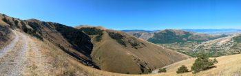
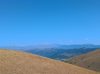
Starting point is Ortona dei Marsi (1,000 meters), the first town in the Abruzzo National Park coming from the Fucino plain, possibly starting from Pescina you can ride the relative climb when the sun is not yet high (Pescina is at the lowest point of the route). You start slightly downhill on a mostly paved road, then a few kilometers uphill and near a bend you take a dirt road on the right that will take you with varying gradients up to 15% up to about1540 meters, crossing a rather bare landscape of trees that allows a 360-degree view of the whole area. In the distance to the north you catch a glimpse of the Gran Sasso.
There follows a long descent, not particularly challenging except for a few bends with some loose gravel, until we come to an intersection with a paved road near a tunnel. This point is identified as the 'Olmo di Bobbio' viewpoint. You immediately leave the asphalt road continuing to the right and with a bit of up and down, this time mostly in the woods, you arrive near some repeater antennas at about 1300 meters above sea level.
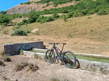
From here you descend again, still on a dirt road that however I think no one uses anymore, often overgrown with stones and branches, perhaps it would be better described as a wide single-track, at times with negative gradients over 20%. Toward the end of this section there is a drinking fountain (as of July 2025 it was active). When you reach the bottom you cross a paved road that you follow for a few hundred meters, leave it and continue left on an uphill section that climbs, without an obvious trail (more or less you can follow the methane pipeline signs until you pass near a couple of pylons without cables, from which you find a trail again), to the Forca Caruso pass (1100 meters) where you find a paved road again.
Continue on the state road (or on the more or less parallel dirt road, but it was closed by a fence so I stayed on the road) until leaving it by taking a new dirt road near some wind turbines and following this (some stretches with somewhat loose stones) downhill until reaching Pescina (700 meters).
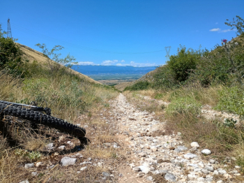
Leaving Pescina, start again on a new dirt road for the second long climb of the tour, which is rather sunny and initially also traveled by some trucks from a quarry along the way. After about 9 km uphill at about 1200 meters the road becomes paved again and we begin to descend again toward Aschi and then via SP17 back to Ortona. Theoretically from Aschi there should be a possibility to continue to Ortona via trail but after a marked start I could find no more traces of it and being alone I returned to the provincial road.
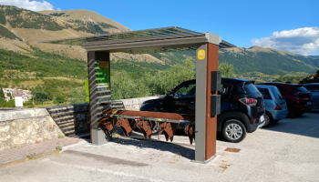
In all it is about 57 km with 1700 m of elevation gain, done with an unassisted bike. For those who want to do it by ebike I point out that in Ortona there is a charging station with dedicated cables for the main motor brands (Shimano, Bosch, Yamaha, Brose).