
 Italiano
 Deutsch
Maggiorasca, Fontana gelata e Valle Tribolata

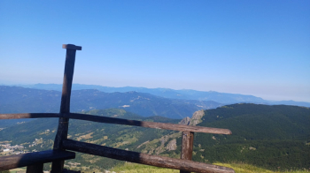
To escape the heat of the coast, a nice route that starts in Rocca d'Aveto, from the convenient parking lot at the end of the road. We warm up immediately with the ramps that lead to the cross-country trail that leads to Tomarlo; when we reach the asphalt, we turn left and continue after the pass until we take the dirt road to Prato Grande on the left. Reaching the refuge we climb up the meadow on a barely visible track and then take a left uphill. We leave the trail for a hidden track on the left that takes us to the ski slope coming down from Mount Bue. Here we keep left and climb the last few ramps before reaching Maggiorasca. The view on a clear day is beautiful, ranging from the sea to the Apennines.
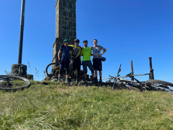
Group photo and then the descent begins.
We have to be careful on the first part which is exposed, then after that we enter the woods and it becomes enjoyable. We pay attention and take the traverse to the right that takes us to the Prato della Cipolla passing by the Croce Martincano. When we reach the refuge we can refresh ourselves and fill our water bottles. Past the refuge we take a right towards the Astass refuge, which we will not reach because we turn right again towards the Fontana Gelata, which is reached by a nice trail flow. From here we continue on eat-and-drink trail toward Zovallo Pass, paying attention to hikers who are numerous.
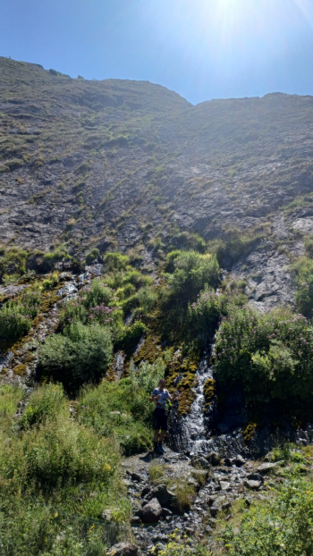
Back on asphalt we descend to the left downhill, lose elevation for a couple of kilometers and then take the dirt road to the left that takes us to Crociglia pass, avoiding the sun-exposed asphalt climb. When we reach the pass we take the level path to the left, after a few hundred meters we turn right towards the Tribolata Valley, which opens up below Ciappa Liscia. Recommended is the detour to the spring to cool the boiling spirits with the water coming out of the rock.
We exit the valley with a bit of uphill biking, then rejoin the trail down from Groppo Rosso. To return to Rocca d'Aveto there are two alternatives, the shorter one is taken to the right, while this trail follows a longer loop on the crest of the middle mountain, then returns to Rocca on single track.
