
 Italiano
 Deutsch
Anello Orobico del Madonnino discesa Cardeto (2 giorni)

Orobico ring of Madonnino descent Cardeto (2 days). Epic tour of those that remain in the heart. 3200 meters of dislviello and 50 km with final descent from the beautiful vale of Cardeto. In the original version I did the full tour in 12 hours following this trail but I suggest doing it more slowly enjoying the scenery and stopping to sleep at the Gemini refuge. In this version, the final descent is more beautiful and continuous and comes down from the Cardeto valley
Cardeto descent video starting at min 0:30
DAY 1.
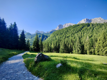
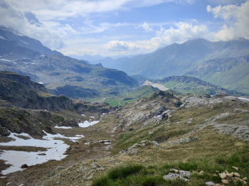
Start from Gromo, continue on asphalt climbing towards Valcanale on the comfortable road (water) and admiring the magnificent east face of the Vaccaro, and of the Arera we pass next to the beautiful small lake of Valcanale. Leaving the asphalt we continue on concrete completely rideable but experience tells me not to dare and save the leg in the sections too steep.
Arriving at the Alpecorte refuge (open year-round, water point), we set off again at a good pace toward the Branchino pass. The climb up to the pass is completely rideable on emtb, while on mtb we do a good 70 percent
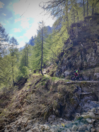
From Branchino we stop for a moment to admire the beautiful valley and continue past Branchino Lake and then stop at the pass (1820 meters) to put on the protections. Branchino - Baite di Mezzeno descent, this is classic alpine trail diff S2+/S3 with fast sections and several very interesting passages.
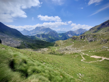
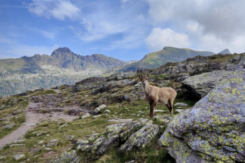
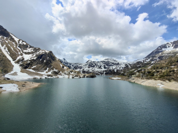
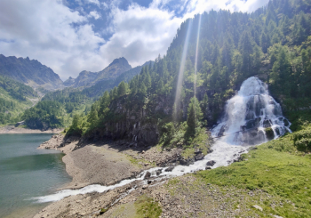
At Baite di Mezzeno (1600 meters, water) we climb for about 500 meters with the bike on our shoulders up to the Mezzeno Pass (2142 meters) from which we can admire the fantastic valley of Roncobello from which the Menna stands out. Descent Punta di Mezzeno - Rifugio Gemelli Descent S4 very technical, arrived at the big stone I suggest to keep the right to avoid wedging in the channels of the variant on the left, During the descent the Gemelli Lake opens in front of us. At Gemelli (1950 meters, water) we will have traveled about 1900 meters of elevation gain (1200m pedal and 500m shoulder and 200 pushing) For those who have never visited the area it is possible to visit all 5 lakes, climbing in about 100 meters pedalable to Lake Colombo and then descend to Lake Becco, Lake Marcio, Lake Pian delle Casere, and then return to ref. Gemelli in about 150m pedalable sections
DAY 2
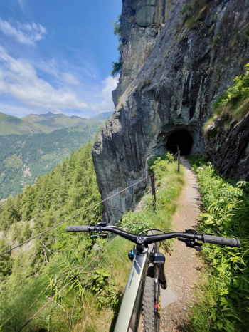
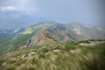
From the Gemelli refuge we descend directly to Lake Pian delle casere, continue from the very scenic flat trail (but with many rocks) beside Lake Marcio. We descend from rocky trail S3 and then deviate to CAI213 trail, it is a beautiful S1/S2 trail with beautiful views, protected but exposed, so maximum attention! Arrived at Sardegnana lake (m 1750 asl) we shoulder up to Sardegnana pass (m1880 asl) We descend the first 30m of the trail on foot (exposed and technical) and then continue on beautiful traverse with many raises.
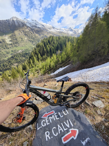
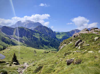
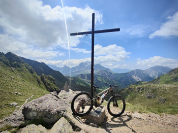
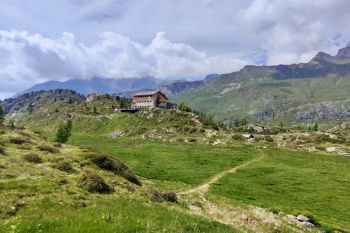
We connect to the cemented road and passing by the side of Fegabolgia Lake we continue on a good pedal to the Calvi refuge (2000m). From the refuge we continue to the Portula pass (2273 meters) in about 300 meters shoulder/push. From the pass the views are fantastic! Now last 220 meters shoulder to reach the summit of Madonnino (2502 meters), top 360° panorama.
Descent
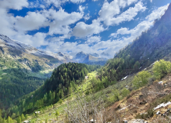
From the madonnino the first 200 meters are steep S3/S4 almost completely doable in the saddle, then follows a short non-pedalable traverse to the Portula pass. From the pass the first part is an S3 with several S4 passages, the difficulty gradually drops to an S1 on the final trails.
Suggestions and variants: from Gemini it is possible to descend 212 (this trail) and seek lodging in Branzi, the next day you will climb to Calvi cutting all the very scenic 213 traverse. It is possible to climb all the way up to below Devil's Peak of Tenda or climb up to Val Sambuzza (this track) or add another day and climb from one of the other tracks in the area (e.g. Val cervia pass (this track).
Video of the descent from Madonnino in the Cardeto Valley.
Trail style: all mountain
Personal rating: views 10/10; descents 9/10
MTB: Yes
EMTB: Not recommended
Duration about 16-20h (by mtb)
Portage: 1200m
Difficulty ascent: very challenging in places
Difficulty descent: P.Branchino 350m S2 / P.Mezzeno 250m S4 / Colombo 200m S2 / P.Sardegnana 150m S2+ / Madonnino 200m S4 / P.Portula S3 / Final trails S1
Exposed: A few protected sections on the traverse 213
Draining: YES
Water points: See description


