HOME RANKINGS CHALLENGES ROUTES NEAR ME PLANNING SEARCH LOGIN
Italy - Piemonte, CN
2025/06/07 12:08:48

Giro della Meja

53 Downloads
0
 
Share

Key Takeaways / Scheda Tecnica

Disciplina:
Mountain Bike (MTB)
Percorso:
Giro della Meja
Località:
Italy - Piemonte, CN
Distanza:
44,46 km
Dislivello Positivo:
+2 100 mt (Quota Min: 1188m - Max: 2521m)
Difficoltà Tecnica:
4/5
Valutazione Panorami:
5/5
Formato Traccia:
GPX Download disponibile
Author
Staff
(110)
Place
Italy - Piemonte, CN
Km
44,46 km
Elapsed time
00:00:00
Vertical meters
+2 100 mt (1188 - 2521)
Route difficulty
Landscapes
Last update
2026/08/31 13:04:18
Comments
0
Description

This route winds around Rocca la Meja on the Gardetta Plateau. We start from Marmora on paved road toward Colle del Preit, which we leave behind to take a forest road that leads us easily to a mountain pasture at an elevation of 2,100 meters. From here, over a 150-meter climb, the pedaling effort is minimal until the view of Lago Nero comes into sight. We now ride along a trail, skirting the small lake. We now climb, partly by pedaling and partly by pushing the bike, until just above a small pass where a marvelous view opens up over the Gardetta Plateau, with La Meja to our left.

We now begin a descent characterized in the first part by a scenic ridge and then by a winding, technical section that leads us to a fork in the trail. From here, to avoid losing elevation on the subsequent dirt road, we push our bikes uphill another 100 meters to the Preit Pass. Still on a beautiful, scenic trail—now easier—we descend into a valley and then follow a forest road up to the Gardetta mountain hut. From the hut, we climb to the pass to take in the view of the opposite slope, dominated by Mount Oronaye. We climb a bit further and take a trail that leads us back to the refuge. We ride comfortably along the plateau’s forest road to the Colle del Mulo, enjoying beautiful views. We now begin the very long final descent that takes us back to Marmora. The first section runs through a fantastic alpine valley. The trail then enters the woods, and the fun continues all the way back to the starting point.

The sections requiring pushing total no more than 250 meters of elevation gain.
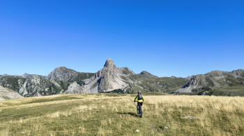
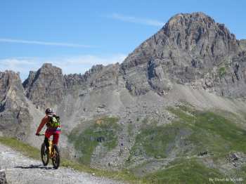
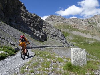
Foto itinerario MTB Giro della Meja - Italy - Piemonte, CNFoto itinerario MTB Giro della Meja - Italy - Piemonte, CNFoto itinerario MTB Giro della Meja - Italy - Piemonte, CN

Download our free mobile app to send this route to your Garmin device or to navigate it on OSM maps. Android - iOS
Local weather
Mar 00:00
10 °C
Mar 12:00
10 °C
Mer 00:00
10 °C
Mer 12:00
16 °C
Gio 00:00
8 °C
Gio 12:00
12 °C
Ven 00:00
7 °C
Ven 12:00
7 °C
Sab 00:00
5 °C
Sab 12:00
10 °C

Graph

Nearest Routes

2023/07/04
- Italy - Piemonte, CN
Church
(2)
52,25 km
Km
+2 089 mt
Vertical meters
Route difficulty
Landscapes
2023/07/24
- Italy - Piemonte, CN
svicino
(2)
36,04 km
Km
+1 543 mt
Vertical meters
Route difficulty
Landscapes
2023/12/04
- Italy - Piemonte, CN
nonnocarb
(324)
13,84 km
Km
+550 mt
Vertical meters
Route difficulty
Landscapes
2023/12/04
- Italy - Piemonte, CN
nonnocarb
(324)
24,00 km
Km
+1 080 mt
Vertical meters
Route difficulty
Landscapes
2023/12/04
- Italy - Piemonte, CN
nonnocarb
(324)
14,54 km
Km
+850 mt
Vertical meters
Route difficulty
Landscapes
30,13 km
Km
+1 667 mt
Vertical meters
Route difficulty
Landscapes
2026/07/18
- Italy - Piemonte, CN
Seraffo85
(21)
21,99 km
Km
+1 100 mt
Vertical meters
Route difficulty
Landscapes
2022/08/06
- Italy - Piemonte, CN
gmzolenart
(137)
32,26 km
Km
+1 599 mt
Vertical meters
Route difficulty
Landscapes
2023/01/25
- Italy - Piemonte, CN
BAROLO71
(35)
21,95 km
Km
+1 418 mt
Vertical meters
Route difficulty
Landscapes
2025/08/06
- Italy - Piemonte, CN
Nitros
(10)
57,52 km
Km
+3 131 mt
Vertical meters
Route difficulty
Landscapes

0 Comments