Riassunto Apuano, da Corogno al Piglione
I decide to start from the curve of Christ just above Pescaglia also in consideration of the fact that not more than two weeks ago it was blowing strong winds and I am afraid that the paths leading further downstream are not in good condition. Having parked the car in the wide space I head for Passo Sella on a slight climb, good for a pre-warm-up. At the pass I turn left, the climb becomes steeper but never excessive. Arriving in Groppa the road ends and past the group of houses I take Cai 103. Initially too steep to be pedaled I load the bike on my shoulders and ride a section of it that is not very long.
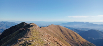
Having found more acceptable gradients I get back on the saddle, descending on a few raises and at a couple of points where I find as I imagined plants on the ground, but nothing really important and easily passable. Coming out of the woods the most beautiful part of this traverse begins, running at the foot of the Piglione up to the Parte offering spectacular panoramic views of the southern peaks of the Apuan Alps and of the entire completely snow-covered Apennine arc. At Parte, still following Cai 103, I head toward Foce del Termine, take Cai 2 and descend to the road and regain the route that leads toward Alto Matanna.
The slope here is more challenging but fortunately the stretch is short and before long I reach the refuge. Without pausing I continue toward the Foce del Pallone on a slight ascent but on a scurvy stretch after which I arrive at a plateau where I decide to take a short break,eat something and drink some hot tea. After restarting I have a challenging downhill section on Cai 101 that takes me back to Termine from where I continue the descent on Cai 102 towards Casoli, perhaps the most difficult section of the day: technical fun but where you have to be very careful in the points of strong exposure on spectacular rock passages.
At about 770 meters altitude near a viewpoint I take the path that leads to Corogno a group of practically abandoned Houses in the middle of the valley below Mount Matanna. The section that until a few years ago was little known is now certainly more frequented but still remains very wild and only improves near the village where it is somewhat cleaned in the section where there is a water pipe from the hypothetical aqueduct. From the village there are two variants, I take the one that causing me to lose less elevation gain leads me to Cai 112, where I am forced to push the bike for about 60 meters of elevation gain until I find the marker that indicates Metato/104.
Even on this stretch I have to alternate between pedaling and pushing on a couple of steep raises, which I continue to do even when I reach Cai 104, at least in the part in the woods, after which begins the section on the mountainside of Mount Prana, stupendous, all pedalable until the focetta of San Vincenzo where I continue the descent on Cai 101, which I abandon to head toward Baita Barsi and then on the very enjoyable trail that leads to Ritrogoli.
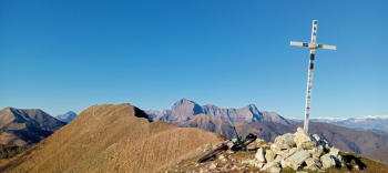
At this point I could also end the tour by following the road but the day is too beautiful and the summit of Piglione is there to tell me that there is no better opportunity, so when I get to Rinchiani I turn left onto the dirt road that leads me back to the Parte where without delay I load my bike on my shoulders and climb the summit trail. From an altitude of 1100 for about 40 meters of elevation gain you can once again resume pedaling for a mostly flat section, you just have to pay attention to some rocky passages hidden by the paleo, while in the last meters you are again obliged to push or load the bike on your shoulders up to the saddle placed between the two peaks North and South. Without stopping I continue on my way to the North summit and past the steepest section it can be reached on the pedals.
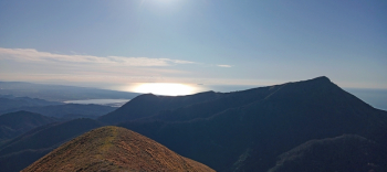
I linger a few minutes admiring the beautiful 360-degree panorama over most of the Apuan Alps, the Apennines and the sea with the Ligurian and Livorno gulfs until I catch a glimpse of the island of Elba. From the summit I descend again to the saddle and head to the South to take a couple more photos and then begin the beautiful descent that ends on the road at the height of Marginetta where the path to Covalle called Indiano would begin, which as anticipated today I decided to skip having the fear of finding disasters there and not ruin my day. All that remains is for me to continue downhill along the road and reach the starting point.


 Italiano
 Deutsch