Italiano
 Deutsch
Monte Matanna e Piglione nord

Despite a modest mileage and elevation gain, the ride has a nice intensity due to the steep climb to the upper Matanna and a good amount of shoulder biking to reach first the summit of Matanna and then the north summit of Mt. Piglione.
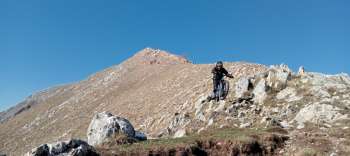
Leaving the cars at Christ's Curve we quickly reach Sella Pass where we warm up immediately with two downhill cuts to avoid the asphalt road leading to Sano Rocco in Turrite. From the latter we resume the climb that leads to the upper Matanna passing through Pascoso and Bucino. Arriving at the refuge, we stop for a brief rest and then tackle the first and most important stretch of bike backpacking. We take CAI path 5 that leads to Callare and from here we follow the ridge path on the left passing a metal gate. Immediately very steep and treacherous due to the snow left on the north side we reach the ridge with no small effort also because today a cold wind is lashing, not excessive but annoying. Having reached the ridge we can already distinguish the summit cross which we reach more easily.
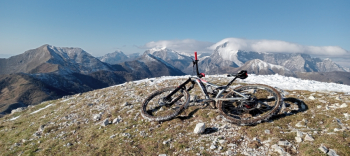
The descent is not continuous since an intermediate section is not cyclable, but once past it we practically will not get off the bike again until the mouth of the Termine. From the latter we decide to stay on the ridge and in the sun given the temperatures. Upon reaching La Parte we stop for a rest before climbing to the top of Piglione.
This second push/bike-to-shoulder section is much less challenging and we reach the saddle of the mountain easily while also alternating some pedaled sections. Upon reaching the summit I stop for only a few seconds to take a photo and then jump downhill and reach the saddle again while Manuel tries to film me with the drone, but unfortunately the day is too windy to make a safe flight.
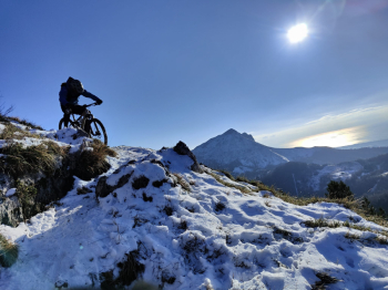
The itinerary would include reaching the South summit but evaluating that we would then have to descend on the North slope all in the shade and always snow-covered, we opt for the outward route to return again to the Parte route where we continue on CAI path 103, wonderful as always super panoramic in the first section and today covered with snow, truly magical.
When we reach Groppa, all we have to do is follow the asphalt road to the Sella Pass and then continue downhill until we reach our cars.