HOME RANKINGS CHALLENGES ROUTES NEAR ME PLANNING SEARCH LOGIN
Italy - Piemonte, TO
2024/10/12 22:09:39

Bassa Val Susa - Alpe Ghet - sentieri 567, 547 e 548
5 Downloads
0
 
Share

Key Takeaways / Scheda Tecnica

Disciplina:
Mountain Bike (MTB)
Percorso:
Bassa Val Susa - Alpe Ghet - sentieri 567, 547 e 548
Località:
Italy - Piemonte, TO
Distanza:
26,51 km
Dislivello Positivo:
+1 080 mt (Quota Min: 627m - Max: 1543m)
Difficoltà Tecnica:
2/5
Valutazione Panorami:
3/5
Formato Traccia:
GPX Download disponibile
Author
gmzolenart
(137)
Place
Italy - Piemonte, TO
Km
26,51 km
Elapsed time
05:14:36
Vertical meters
+1 080 mt (627 - 1543)
Route difficulty
Landscapes
Last update
2024/10/13 10:10:09
Comments
0
Description

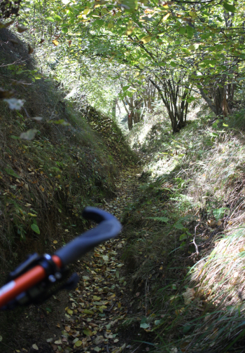
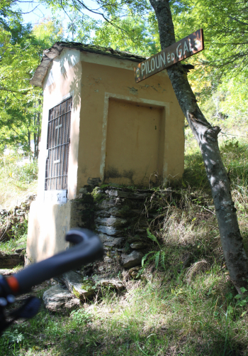
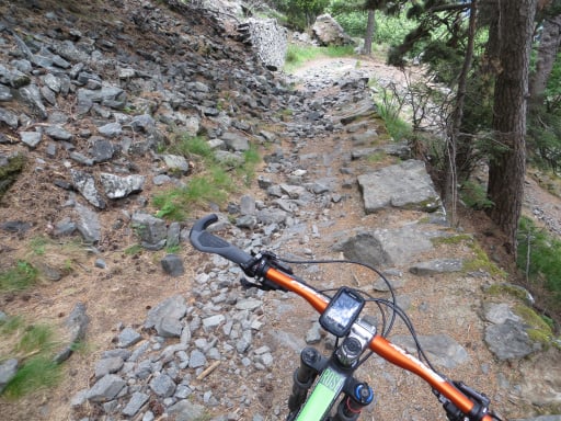
Parking lot in Giagli, ascent on asphalt to Mocchie and then hamlets Gagnor, Bigliasco, Dravugna and Prato del Rio, at times with significant gradients. You arrive by a votive pillar and take trail 567 left to Alpe Vaccherezza and Alpe Gragor. The descent trail 547 is well marked, it is about 4 km to Prarotto, initially on meadow, then nice stretch between two grassy banks, in succession traverse with thistles, some wet and rocky passages, a few short climbs, continue through chestnut forest to the pilon ed gal.

Ascend briefly on asphalt to Prarotto and then descent trail 548, very flowing in chestnut forest through hamlets Airassa, Colombatti and finally Giagli. Tour with very rewarding climb, recommended in spring and fall considering the totally southern exposure.

While going up to Alpe dei Rat the view would be towards Sacra di San Michele and the lakes of Avigliana, on this side going towards Alpe Ghet the Punta Lunella stands out, downhill on the horizon Cristalliera, Costabruna and Aquila.
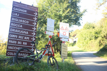
Foto itinerario MTB Bassa Val Susa - Alpe Ghet - sentieri 567, 547 e 548 - Italy - Piemonte, TO

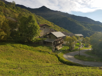
Bigliasco

Foto itinerario MTB Bassa Val Susa - Alpe Ghet - sentieri 567, 547 e 548 - Italy - Piemonte, TO

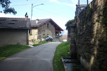
Dravugna

Foto itinerario MTB Bassa Val Susa - Alpe Ghet - sentieri 567, 547 e 548 - Italy - Piemonte, TO

Rio Meadow

Foto itinerario MTB Bassa Val Susa - Alpe Ghet - sentieri 567, 547 e 548 - Italy - Piemonte, TO

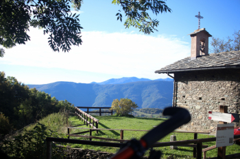
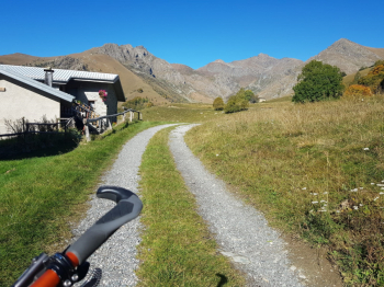
Trail 567 to Alpe Vaccherezza and Alpe Ghet
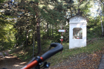
Foto itinerario MTB Bassa Val Susa - Alpe Ghet - sentieri 567, 547 e 548 - Italy - Piemonte, TO


Foto itinerario MTB Bassa Val Susa - Alpe Ghet - sentieri 567, 547 e 548 - Italy - Piemonte, TO

Detail of trail 547

Foto itinerario MTB Bassa Val Susa - Alpe Ghet - sentieri 567, 547 e 548 - Italy - Piemonte, TO

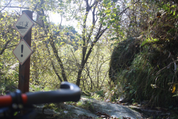
Signage

Foto itinerario MTB Bassa Val Susa - Alpe Ghet - sentieri 567, 547 e 548 - Italy - Piemonte, TO


Foto itinerario MTB Bassa Val Susa - Alpe Ghet - sentieri 567, 547 e 548 - Italy - Piemonte, TO

When people used to ski in Prarotto...industrial artifact from the 1960s, installed by the municipality of Condove
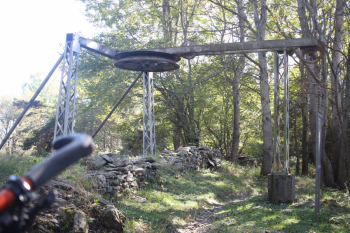
Foto itinerario MTB Bassa Val Susa - Alpe Ghet - sentieri 567, 547 e 548 - Italy - Piemonte, TO


Download our free mobile app to send this route to your Garmin device or to navigate it on OSM maps. Android - iOS
Local weather
Mar 00:00
13 °C
Mar 12:00
11 °C
Mer 00:00
12 °C
Mer 12:00
14 °C
Gio 00:00
12 °C
Gio 12:00
14 °C
Ven 00:00
10 °C
Ven 12:00
10 °C
Sab 00:00
7 °C
Sab 12:00
14 °C

Graph

Nearest Routes

2022/10/05
- Italy - Piemonte, TO
gmzolenart
(137)
23,24 km
Km
+1 105 mt
Vertical meters
Route difficulty
Landscapes
2022/11/04
- Italy - Piemonte, TO
gmzolenart
(137)
15,96 km
Km
+718 mt
Vertical meters
Route difficulty
Landscapes
23,32 km
Km
+970 mt
Vertical meters
Route difficulty
Landscapes
2022/11/03
- Italy - Piemonte, TO
gmzolenart
(137)
22,02 km
Km
+897 mt
Vertical meters
Route difficulty
Landscapes
2022/09/26
- Italy - Piemonte, TO
gmzolenart
(137)
20,27 km
Km
+1 044 mt
Vertical meters
Route difficulty
Landscapes
2022/11/02
- Italy - Piemonte, TO
gmzolenart
(137)
16,29 km
Km
+751 mt
Vertical meters
Route difficulty
Landscapes
2026/08/26
- Italy - Piemonte, TO
gmzolenart
(137)
21,77 km
Km
+920 mt
Vertical meters
Route difficulty
Landscapes
2026/09/20
- Italy - Piemonte, TO
gmzolenart
(137)
12,66 km
Km
+650 mt
Vertical meters
Route difficulty
Landscapes
2023/02/20
- Italy - Piemonte, TO
gmzolenart
(137)
17,05 km
Km
+930 mt
Vertical meters
Route difficulty
Landscapes
28,99 km
Km
+1 193 mt
Vertical meters
Route difficulty
Landscapes

0 Comments