Italiano
 Deutsch
Monte Mazzoccone – sentiero Beltrami (da Alpe Camasca a Cireggio)

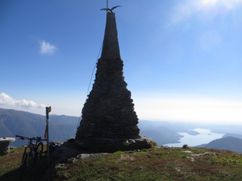
Started from Omegna, cemetery parking lot, directions to Quarna di sotto, 6 km of asphalt. On the route encountered at least thirty cyclo-tourists of which those with bdc continued on asphalt to the alpe, mtb entry into Quarna di sotto and even steep roads to dirt road to Alpe Camasca (1230 m). On Saturday, Oct. 13, they had organized an aperitif, the Funtos Bike (more than 100 card-carrying members for cyclo-hiking and cyclo-amateur activities). Here the roads separated, they were doing a loop from Alpe Ranghetto and Laghi di Nonio, instead for Mt. Mazzoccone go up to the left of Alpe Camasca to Co di Stobj (1265 m). Signs point right to Monte Mazzoccone at 0.45 minutes: follow the dirt road through the woods for about a kilometer, you will come to a false flat (elevation about 1300 m. At this point you should NOT continue, but take small path to the right. It is the only non-obvious fork in the whole trail (I left in the trail a smudge), start spintage on steep unmarked trail to the ridge and Mount Mazzoccone (1424 m), it is about 150 m of elevation gain pushing or carrying the bike which takes 15-20 minutes.
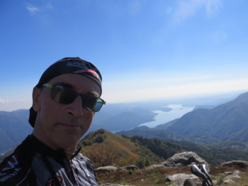
Great views from the summit, entire Lake Orta to the south, Strona Valley to the north.
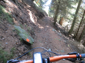
Descent: descend from the uphill side for about 100 m, then turn left on path (T20) well marked and signaling (red dots and flags) is almost continuous to Cireggio. This is a section of the Beltrami trail, named after the anti-fascist partisan Beltrami: the trail connects Cireggio to Megolo, the beginning and the end of its history.
It starts with a flow section up to Alpe Camasca, continues with long traverses (and a fountain) alternating with steeper, wide and not very technical sections up to Upper Quarna where we intersperse a viewpoint over the lake.
The section from Upper Quarna to Cireggio is fixed cobblestone, quite steep and narrow, with votive chapels. From Cireggio to Omegna asphalt.
Map Geo4Map No. 17 Mottarone Lago d'Orta Lago Maggiore Scale 1:25,000
Elevation gain 1200 +, difficulty MC/BC.