Italiano
 Deutsch
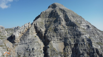
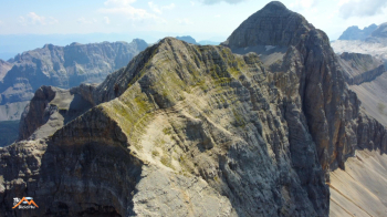
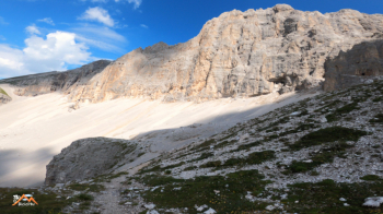
Cima Vagliana (anticima)

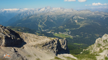
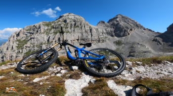
For this beautiful cycle aplinistica we start from above Madonna di Campiglio, before the gondola to Grostè. We bike into the parking lot of the gondola and at the far end, to the left, begins a flat forest road that will lead us after 2.5 km to the Mondifra hut and shortly after to the junction with the path to Val Gelata / Bocchetta dei Tre Sassi. Until just before the Bocchetta there is little pedaling, pushing and shouldering for 900 meters of elevation gain in a first-rate dolomite environment, and this is invigorating to say the least.
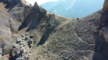
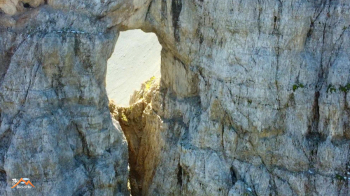
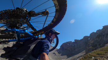
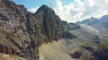
Just before the Bocchetta, we already notice it from below, a beautiful groove cuts through the scree below the long, jagged ridge of Cima Vagliana that joins the Pietra Grande, Spectacular! We ride along this scenic stretch with a few short pedalable climbs passing under the striking Finestra della Vagliana the most impressive rock arch in the area. As soon as we reach the turning point we bend sharply to the left without giving in to the temptation to follow the beautiful path in front of us and climb toward Cima Vagliana on faint trail that you easily lose it but then find it again as the path is logical. I climbed for about 200 meters of elevation gain from the turnaround point with bike on my back, then continued a section without a bike but soon realized I was trespassing in another area so I returned to enjoy in serenity what ended up being the best downhill segment of the trip.
We cycle without an obligatory path to the previous turnaround point, the segment as I said the tastiest of the outing and, this time we throw ourselves onto the trail that previously attracted us so much but in fact the undulating motion of the path forces us into short but frequent climbs not all of which are rideable. The environment is constantly a spectacle of nature and this by itself justifies the cost of the "ticket." Once we cross the Sentiero Vidi we descend (not always in the saddle) until just before the Graffer refuge where bending to the right we begin the stony, undulating trail to Dos dello Sparaver. From here we descend with fun to the Vagliana malga, then on forestry to the Vaglianella malga where we leave the forestry at the hairpin bend below the malga to take a very fun trail with no name or number (crossed on the way back from the Vidi trail) that will take us to Campo Carlo Magno and then to the car.
This, too, is a beautiful outing for my understanding of MTB and for lovers of the genre.