Anello di San Giacomo, Sestri Levante
Departure from the parking lot of the "G.Sivori" stadium in Sestri Levante. We leave the parking lot by turning right and then go around the traffic circle into Via Bruno Primi, past the bridge over the Gromolo stream, turn left into Via Arnaldo terzi, follow the road and at the first traffic light turn right, taking the uphill Via Mori, in the direction of San Bernardo. Here we make our first scenic stop and take advantage of the only drinking fountain in the churchyard to refill our water bottles. We make a small detour to Villa Costarossa (about 300 meters, up to the white-red posts) to admire a view of the promontory of Sestri Levante with its two bays. We retrace our steps and continue climbing in the direction of Cascine di sotto.
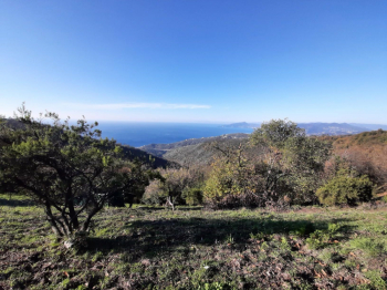
From here the climb continues on asphalt for 1 km until we find the fork to Monte Costello. Here we leave the asphalt, turn left and start pedaling on a forest road for another 2 km, with a few short climbs, we reach the picnic area and continue for another 600 meters to arrive at the Monte Costello plain, from which several trails start (Cani, Loto, Barassino, etc.). We pause to admire a first glimpse of the panorama over the entire Gulf of Tigullio.
Our ascent continues to the conquest of Monte Capenardo, at an altitude of 693 meters. Here the path becomes narrower and more technical, with a couple of important tears, where if you do not have a good mastery of the bike (even assisted) it is better to descend and push a few meters.
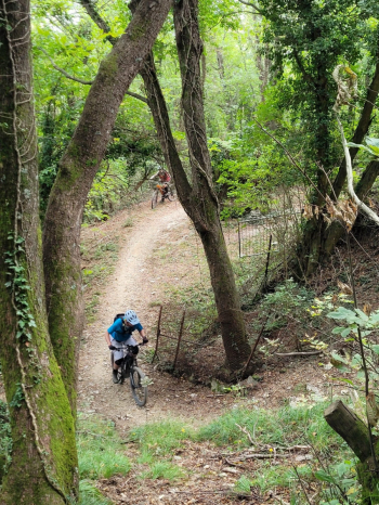
From Mt. Capenardo we continue for about 1 km without being distracted by the view, on a narrow trail in the direction of the crossroads that crosses the ancient via dell'Ardesia and where the actual St. James loop begins.
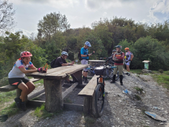
We keep the picnic bench to the right and continue on the trail to the right (in the direction of the chestnut grove), the first slightly exposed section ending after a few hundred meters on a forest road inside the chestnut grove. We ride along the forstale for about 400 meters and at the trivium take the path in the middle, admiring during the ride the different metati (stone buildings used for drying chestnuts).
After about 1 km we come to a junction where we will have to take a left turn and ride a final strenuous uphill stretch, receiving as a reward a fantastic view of the entire Tigullio Gulf, with visibility from Moneglia to Portofino, but the view also reaches the distant Maritime Alps.

If the sky is particularly clear, Corsica could also be seen. Impossible not to stop here, first to catch your breath, and then to savor the view. It is really worth it. We get back in the saddle again and continue the trail in an "eat and drink" that takes us to the highest point of the tour, at an elevation of 701 meters on Mount Rocchette.
From here begins a descent, a bit technical in places, that brings us back to the crossroads, from which we take the same trail as on the way up, to reach Mount Capenardo again and descend to the plain of Mount Costello. At this point we turn sharply to the right to take the Barassino trail, a fun single track, narrow, with steps and roots in sequence, that flows onto SP45 between Sorlana and Barassi. Once we reach the asphalt we continue left towards Barassi, which we pass and descend to Cavi Borgo. From here we necessarily have to get off the bike to face about fifteen steps uphill, with a bike ramp alongside, and take a narrow passage on cobblestones, in the direction of Rocche di S.Anna.
The passage leads onto CAI trail, which crosses the C.L.E.D.A.I. village and takes the "Wayfarer's Path."
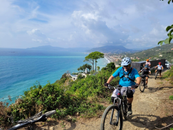
CAUTION! The first part of this trail has some sheer passages with no protection. If you suffer from vertigo, it is better to get off the bike and push a few meters. We soon reach the ruins of the Rocche di S.Anna with a breathtaking view of the bay of Sestri Levante.
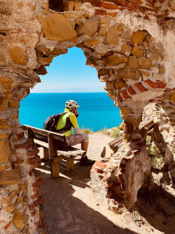
From here we continue along the "Road of the Roman Bridges" which in a short time takes us down to Sestri Levante for good. A refreshing stop at the Girls' Kiosk, and we continue following the bike path, returning to the stadium parking lot, where the tour ends.


 Italiano
 Deutsch