HOME RANKINGS CHALLENGES ROUTES POI PLANNING SEARCH LOGIN
Italy - Lombardia, SO
2024/09/04 20:53:53

Punta di Rims da Santa Maria in Mustair

9 Downloads
1
 
Share
Author
nonnocarb
(292)
Place
Italy - Lombardia, SO
Km
56,39 km
Elapsed time
05:15:35
Vertical meters
+2 200 mt (1375 - 2937)
Route difficulty
Landscapes
Last update
2024/09/04 22:00:16
Comments
0
Description

Let's face it, for me this is by far the most beautiful ride I've done this year!
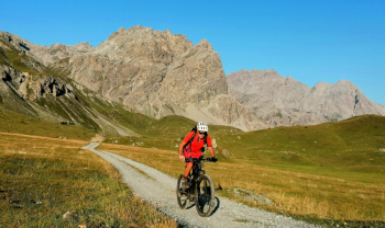
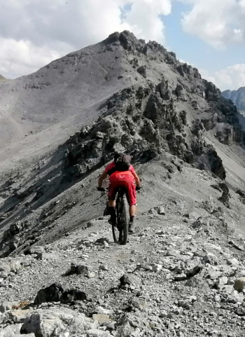
On a fully pedalable ebike and almost completely even without a motor (with good technique, if not you push both uphill and downhill, depending on your ability), spectacular views that change every 5 minutes, rocky peaks, mountain lakes, man-made lakes, moonscapes over 3000 meters, old military trails and technical trails, endless scree and meadows, marmots and ibex in abundance. There is something for everyone.
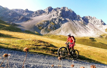
Almost 60 km and 2200 meters of elevation gain with virtually no asphalt. For convenience I start from Santa Maria in Val Müstair, just over the Swiss border at Tubre. For departure from Cancano lakes or Livigno click here.
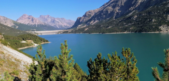
You immediately ascend into Val Mora, a wonderful, wild, almost enchanted, very long valley. With a beautiful path you descend to the Cancano lakes, with their emerald color and green meadows.
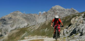
From here we climb with many hairpin bends on an old military road to the Bocchetta di Pedenolo and then further up, to the summit of Rims, almost 3,000 meters, with spectacular views of Ortles, Stelvio and much of the Lombard and Swiss Alps.
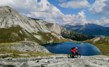
To finish, a magnificent and very varied descent to say the least, passing scree, the beautiful Rims Lake, technical trails and larch forests to Santa Maria(a description of the freeride scree descenthere ). Unique spectacle!
Download our free mobile app to send this route to your Garmin device or to navigate it on OSM maps. Android - iOS
Local weather
Today
-2 °C
Tonight
-5 °C
Tomorrow
5 °C
Tomorrow night
-2 °C
Monday
6 °C
Monday night
2 °C
Tuesday
5 °C
Tuesday night
-2 °C
Wednesday
5 °C
Wednesday night
-1 °C

Graph

Nearest Routes

2024/01/23
- Switzerland
nonnocarb
(292)
39,39 km
Km
+1 450 mt
Vertical meters
Route difficulty
Landscapes
2024/05/23
- Italy - Lombardia, SO
Staff
(77)
45,60 km
Km
+1 500 mt
Vertical meters
Route difficulty
Landscapes
2023/08/25
- Italy - Lombardia, SO
Maxone1
(10)
26,76 km
Km
+1 500 mt
Vertical meters
Route difficulty
Landscapes
2023/09/15
- Italy - Trentino-Alto Adige/Südtirol, BZ
FiloPado
(3)
157,61 km
Km
+4 520 mt
Vertical meters
Route difficulty
Landscapes
2022/08/19
- Italy - Trentino-Alto Adige/Südtirol, BZ
Giulien
(110)
35,04 km
Km
+575 mt
Vertical meters
Route difficulty
Landscapes
2024/02/02
- Italy - Trentino-Alto Adige/Südtirol, BZ
nonnocarb
(292)
16,43 km
Km
+1 000 mt
Vertical meters
Route difficulty
Landscapes
2023/10/01
- Italy - Trentino-Alto Adige/Südtirol, BZ
Robibz
(19)
27,94 km
Km
+1 313 mt
Vertical meters
Route difficulty
Landscapes
2022/11/04
- Italy - Trentino-Alto Adige/Südtirol, BZ
nonnocarb
(292)
31,74 km
Km
+1 832 mt
Vertical meters
Route difficulty
Landscapes
2024/02/02
- Italy - Trentino-Alto Adige/Südtirol, BZ
nonnocarb
(292)
12,89 km
Km
+450 mt
Vertical meters
Route difficulty
Landscapes
2023/09/14
- Italy - Trentino-Alto Adige/Südtirol, BZ
makihl
(3)
51,99 km
Km
+2 400 mt
Vertical meters
Route difficulty
Landscapes

0 Comments