Bassa di Nara, Ritom e passo del Sole
Epic tour between Blenio and Leventina valleys, with two descents of over 1400 meters of elevation gain each. To limit the overall uphill elevation gain, I recommend taking the Nara chairlifts and/or the Ritom funicular. The tour as you see it here includes only the Nara chairlifts.
And right at the first Nara chairlift we leave the car, pay the 25chf ticket wondering if it is worth spending so much to save 1000 meters of elevation gain, but I'll give you the answer already: yes, it is worth it to be able to enjoy the ride without breaking through the elevation gain, which would otherwise reach 3400 meters. Note that the Nara is only open on weekends. We descend from the very slow second chairlift 200 meters below Lower Nara, which is the first pass of the day. A 30-minute push and we are up.
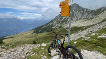
In front of us is the Leventina Valley, that is 1400 meters of elevation gain further down. Do not be discouraged by the path leading to the houses seen in the distance in the photo above: it is stony and in several places you will have to push through pasture. At the houses ignore the red and white signs of the official trail and absolutely follow the trail, because it takes you on a completely cyclable and fun trail, never difficult, to the quaint village of Rossura with its wooden houses.
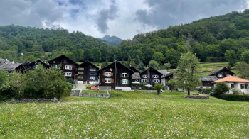
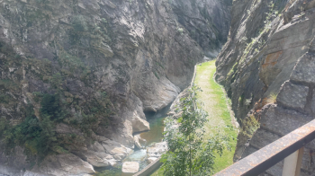
From here the trail becomes rockier but still cyclable and will take us to the valley floor near Faido. The trail now follows the cantonal road to Piotta for several kilometers and 300 meters of elevation gain. There are several restaurants on the route, I point out theOsteria alla Birreria, where I paid for a margherita and a 15chf Coke while sitting at the table. The road has little traffic, since everyone uses the nearby highway, but it offers some very nice views of the Piottina Gorge and you can literally smell the history of the Swiss railways with the many tunnels, even helical ones, that take the trains to the Ambrì plateau where they then enter the historic Gotthard tunnel, opened in 1882 (!).
When you arrive in Piotta you have two options: invest another 25 chf (approximately) for the 800 meters of elevation gain that separate you from Lake Ritom or ride it. I opted for the second one also because I would have had to wait almost 1 hour and in that time frame I was up (pay attention to the times for bikes posted on the website). By the way, the small road is traffic-free and you can most likely admire the famous queue of cars waiting to enter the highway tunnel. Here, think of them in the car, stopped, as you sweat your 7 shirts to get to Lake Ritom.
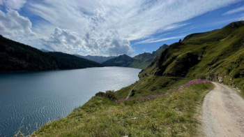
We skirt it on its left side, pass a couple of huts, and then we are on our own again as we climb up to the Sun Pass.
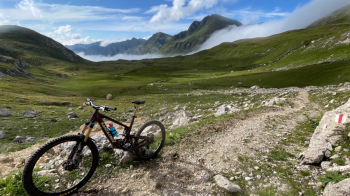
A steep section before the dirt road leading from Man Pass to Sun Pass requires a few meters of pushing and, if you can't take it anymore, even just below Sun Pass. The reward is the magnificent views and especially the view of the very long trail ahead.
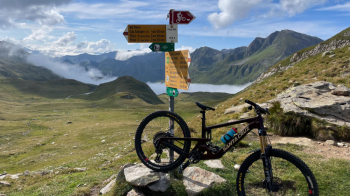
The descent, which leads all the way over Olivone, is extremely varied. Initially alpine and flowing, as it enters the woods it becomes steeper and was initially prepared for bikes After it becomes more rocky, with several bucolic plateaus to cross and slowly increases in difficulty, with rocks embedded in the ground to overcome while looking for the right line. If it is wet the part in the woods can get tricky.
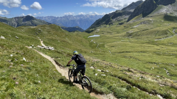
It is one of my favorite descents because of how it changes as you descend, I would say S2 with some S3 passages. Above Olivone we leave aside the more difficult part and follow the paved road to a left turn and from here begins our odyssey between small roads and trails to get to the final climb to retrieve the car at Nara. Little traffic, but your legs will begin to beg for mercy. I assure you that after a good shower and a super dinner you will sleep very well.


 Italiano
 Deutsch