Italiano
 Deutsch
Tofane Bike Park

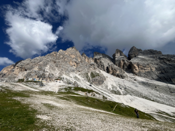
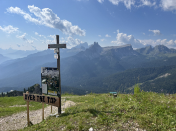
A day of pistini at the Tofane Bike Park, well doable with e-bikes, but with lifts it's even better.Departure from the large Son De Prade parking lot just above Pocol, climb up dirt and back roads to Rif Duca di Aosta and then the very hard climb (push sections) to Pomedes.From here the Over the Top (black) little pistino starts. Very technical, with extreme wall rides and parabolics, steeps, jumps, sections in loose rock, dirt and roots. Definitely technical but very spectacular as a track and views.
At the Duca d'Aosta you take the Krampus (black) pistino, also very technical and challenging, with drops, jumps and steeps that don't leave much breathing room. Here by dirt road you go up to the arrival of the Roncato-Festis chairlift from where another black little pistino starts: T-Rex. Different from the previous ones, definitely acrobatic with gravel bottom, parabolics, jumps to no end (even extreme, but avoidable), doubles and steeps, compressions and mega parabolics, but on the other hand less challenging than the previous ones.
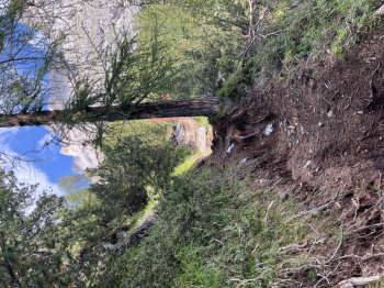
Back up via forestry and small roads to return to the Roncato-Ferris chairlift and this time follow the Barbarian (red) trail. A decidedly classic enough flow trail, but nice long and varied (fast sections , jumps, and a few more technical sections). It connects to the Kikker Rabbit (similar in difficulty) which and varies at Lacedel.Here you go up by forestry first to Pocol and then take cai 403 a well-pedalable single track (95%) that climbs until it intercepts the small road that leads to Rif Duca di Aosta. Here you take the last descent: Tofanina (red). A real treat, very long, very scenic and varied, spectacular as it evolves in the woods above Cortina, a worthy end to the day. You go back up to Pocol and then with the 403 to the parking lot.