HOME RANKINGS CHALLENGES ROUTES NEAR ME PLANNING SEARCH LOGIN
Italy - Veneto, BL
2022/09/21 22:33:49

Cortina - Falzarego super trail

108 Downloads
9
 
Share

Key Takeaways / Scheda Tecnica

Disciplina:
Mountain Bike (MTB)
Percorso:
Cortina - Falzarego super trail
Place:
Italy - Veneto, BL
Km:
33,68 km
Vertical meters:
+1 599 mt (Quota Min: 1161m - Max: 2354m)
Route difficulty:
4/5
Landscapes:
5/5
Formato Traccia:
GPX Download disponibile
Author
Place
Italy - Veneto, BL
Km
33,68 km
Elapsed time
06:20:46
Vertical meters
+1 599 mt (1161 - 2354)
Route difficulty
Landscapes
Last update
2023/08/23 16:02:53
Comments
0
Description

We are in the heart of the Dolomites, more precisely in Cortina, in the Tofane massif, the most majestic of all the mountains overlooking the Ampezzo basin, a favorite destination for hikers and climbers.Although the environment often proves rugged and impassable, with caution and care, the Tofane area, including the Tofane di Rozes, which we are going to visit, can also be discovered by mountain bike. That said, if you don't like carrying your bike on your back a bit, but always repaid by the excellent views, we recommend moving on to the next route.

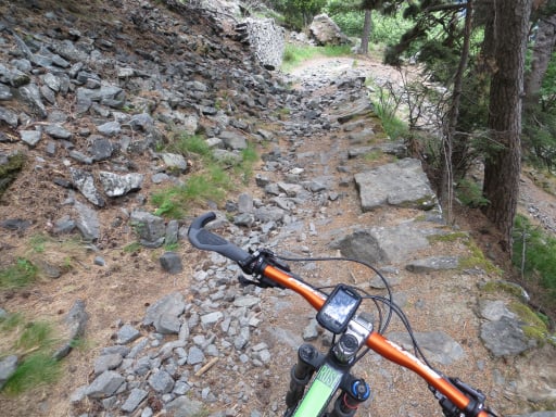
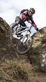
From the ice stadium in Cortina we climb on asphalt to Piè Tofana crossing the ski slope several times, then continuing on the trail, always in the middle of the slopes we arrive at the Dibona refuge. We continue in the ascent, now on the very steep mule track that climbs the scree of Tofana.Reaching an altitude of about 2300 meters, the transfer to the Falzarego pass begins; a challenging and at times exposed trail, with several non-bikeable points; we are crossing the Tofana face. Alternating between dirt road and trail, we now descend to the pass, where the real trail will begin.

The descent flanks the road from the pass down to Cortina, alternating, for more than ten kilometers, dirt road to trail and fast sections to more technical ones; in some points, unfortunately, it will be necessary to get off the mtb.

Cyclability: 85% - suitable for MTB XC/AM/ENDURO.


Download our free mobile app to send this route to your Garmin device or to navigate it on OSM maps. Android - iOS
Local weather
Lun 00:00
1 °C
Lun 12:00
4 °C
Mar 00:00
1 °C
Mar 12:00
8 °C
Mer 00:00
5 °C
Mer 12:00
11 °C
Gio 00:00
7 °C
Gio 12:00
9 °C
Ven 00:00
7 °C
Ven 12:00
9 °C

Graph

Nearest Routes

2026/06/21
- Italy - Veneto, BL
marco
(196)
26,18 km
Km
+1 136 mt
Vertical meters
Route difficulty
Landscapes
2024/04/22
- Italy - Veneto, BL
Gombi
(2)
12,46 km
Km
-614 mt
Vertical meters
Route difficulty
Landscapes
2024/01/16
- Italy - Veneto, BL
@ff.mtb
(9)
48,76 km
Km
+1 500 mt
Vertical meters
Route difficulty
Landscapes
2024/02/05
- Italy - Veneto, BL
@ff.mtb
(9)
40,27 km
Km
+1 300 mt
Vertical meters
Route difficulty
Landscapes
2025/09/16
- Italy - Trentino-Alto Adige/Südtirol, TN
gmzolenart
(137)
31,98 km
Km
+400 mt
Vertical meters
Route difficulty
Landscapes
2026/06/15
- Italy - Veneto, BL
Strauss
(14)
84,53 km
Km
+487 mt
Vertical meters
Route difficulty
Landscapes
2022/10/02
- Italy - Veneto
30,52 km
Km
+1 327 mt
Vertical meters
Route difficulty
Landscapes
2024/07/25
- Italy - Veneto, BL
nonnocarb
(324)
45,46 km
Km
+2 050 mt
Vertical meters
Route difficulty
Landscapes
2024/08/14
- Italy - Veneto, BL
Paoloc1
(141)
29,96 km
Km
+1 832 mt
Vertical meters
Route difficulty
Landscapes
2026/08/19
- Italy - Veneto, BL
Paoloc1
(141)
53,38 km
Km
+2 200 mt
Vertical meters
Route difficulty
Landscapes

0 Comments