
 Italiano
 Deutsch
2024/08/12 14:58:15
All Over
Author

Place
Italy - Emilia-Romagna, BO
Km
18,11 km
Elapsed time
02:47:42
Vertical meters
+718 mt (379 - 760)
Route difficulty
Landscapes
Last update
2025/05/14 14:21:17
Comments
Hotels
Description
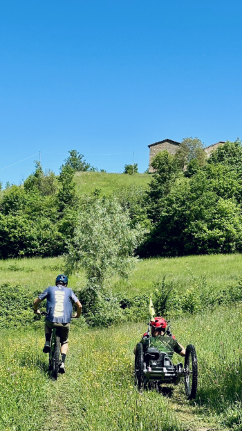
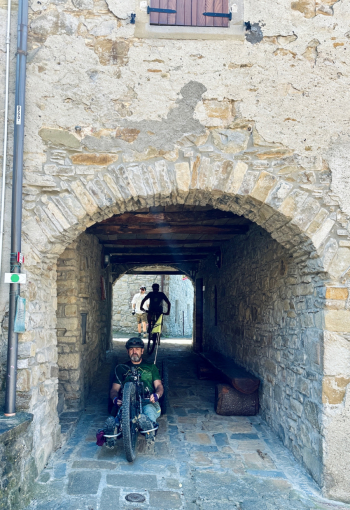
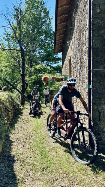
Easy trail to discover the valley of San Benedetto Val di Sambro. The loop trail traverses unspoiled places immersed in nature, where chestnut groves and small fords frame an itinerary that can also be covered by handbike and tandem. Try it throughout the year to appreciate the changing landscape as the seasons change.
Route tabulated with appropriate signage.
Local weather
Thu 00:00

22 °C
Thu 12:00

28 °C
Fri 00:00
25 °C
Fri 12:00
31 °C
Sat 00:00
23 °C
Sat 12:00

30 °C


Graph
Nearest Routes
23,11 km
Km
+570 mt
Vertical meters
Route difficulty
Landscapes
32,44 km
Km
+820 mt
Vertical meters
Route difficulty
Landscapes
26,69 km
Km
+48 mt
Vertical meters
Route difficulty
Landscapes
18,41 km
Km
0 mt
Vertical meters
Route difficulty
Landscapes
43,72 km
Km
+2 000 mt
Vertical meters
Route difficulty
Landscapes
27,26 km
Km
+776 mt
Vertical meters
Route difficulty
Landscapes
19,43 km
Km
+728 mt
Vertical meters
Route difficulty
Landscapes
47,92 km
Km
+2 100 mt
Vertical meters
Route difficulty
Landscapes
38,93 km
Km
+1 600 mt
Vertical meters
Route difficulty
Landscapes
37,18 km
Km
+1 250 mt
Vertical meters
Route difficulty
Landscapes